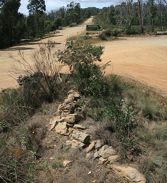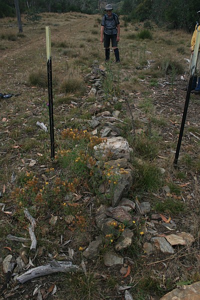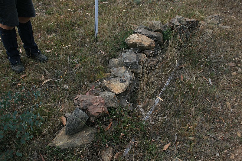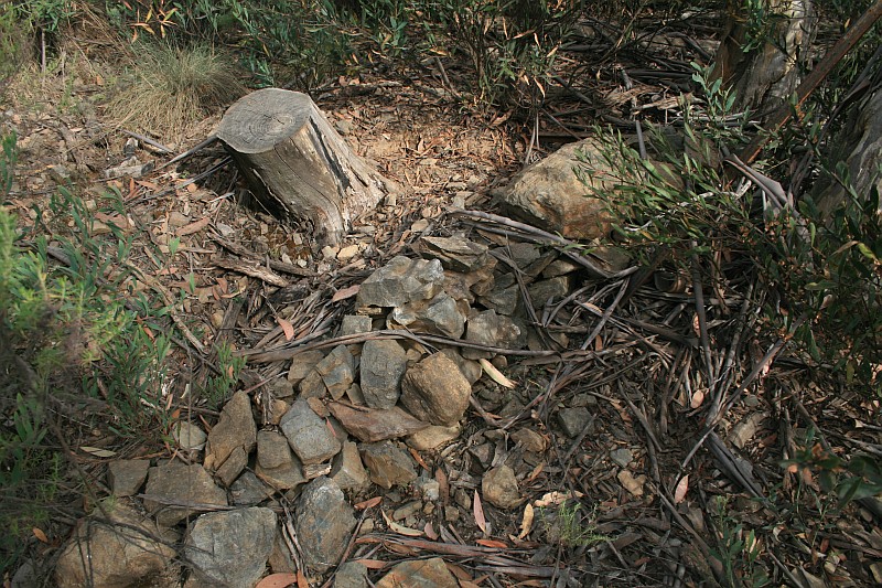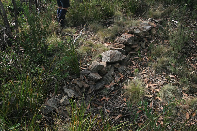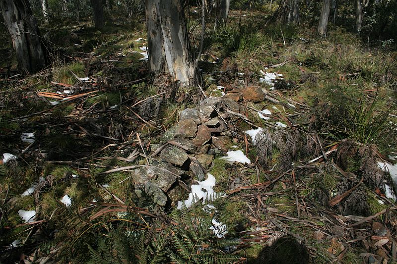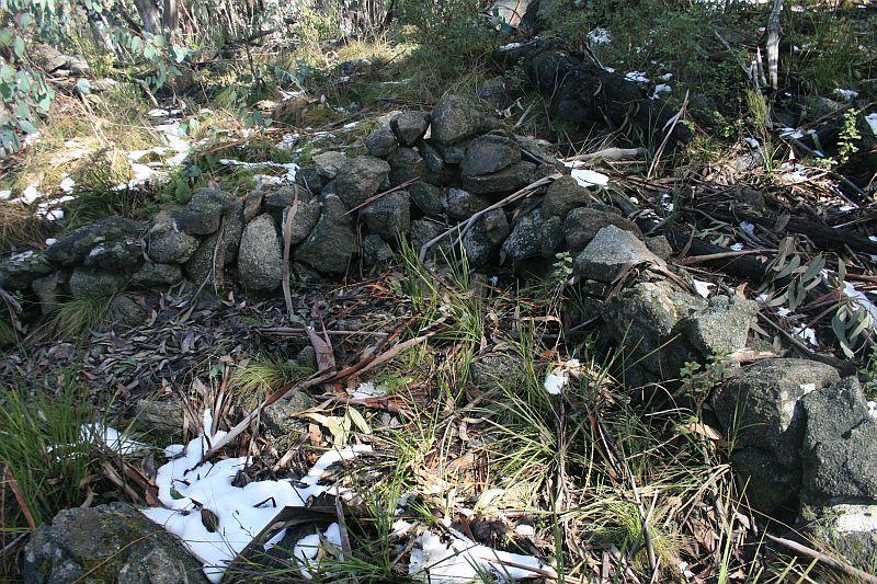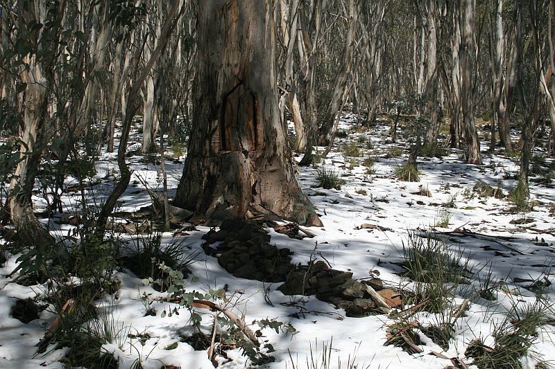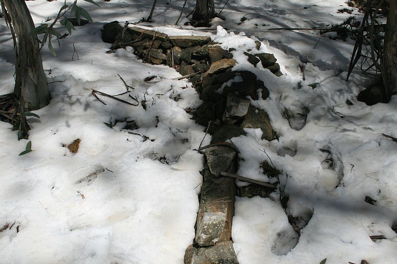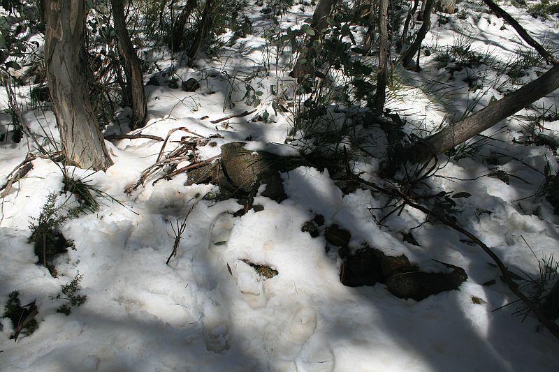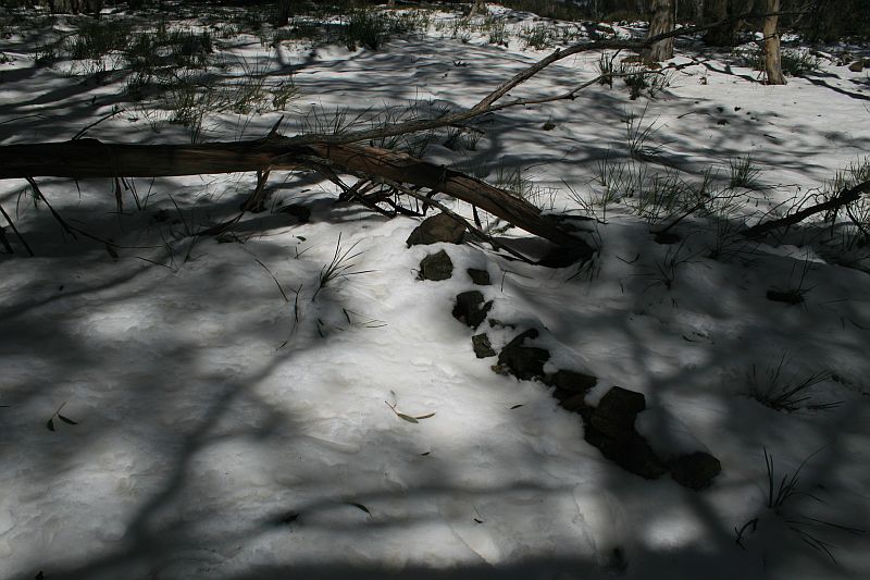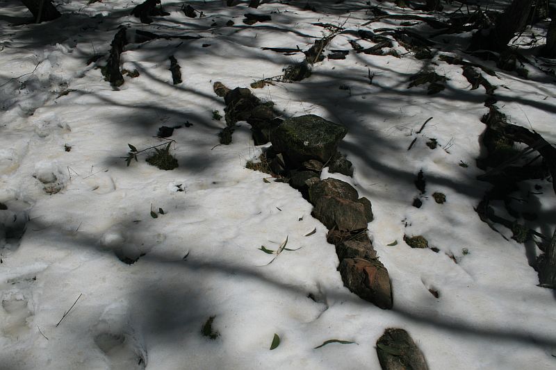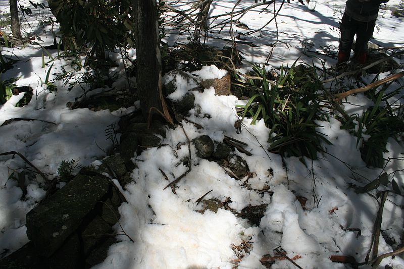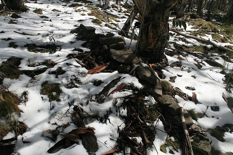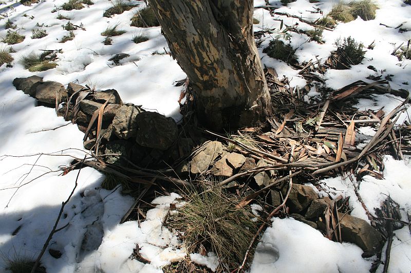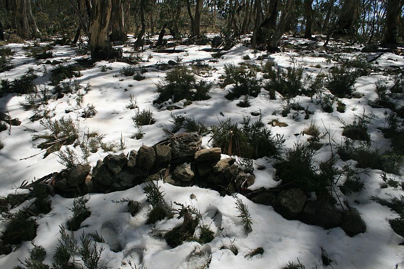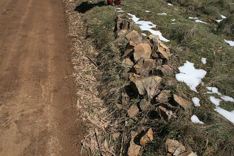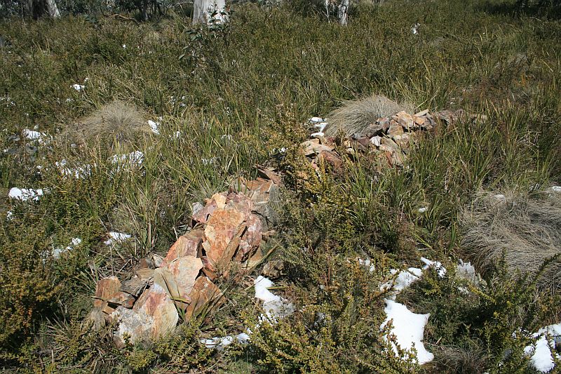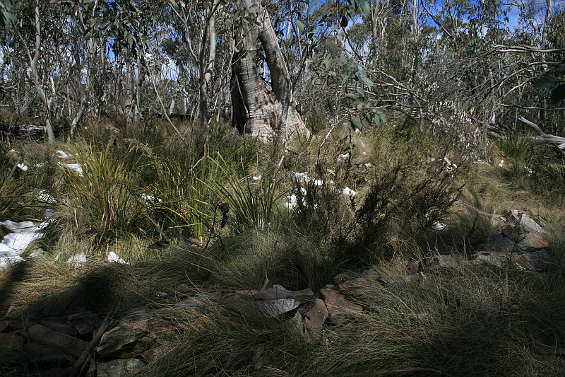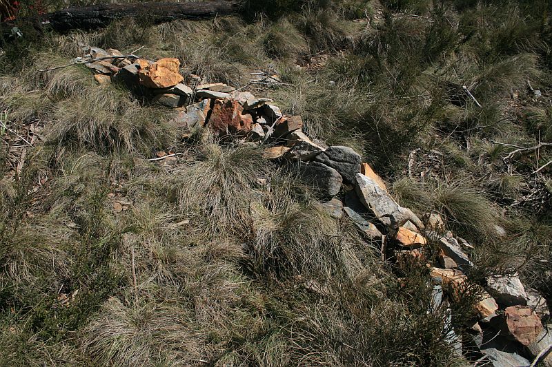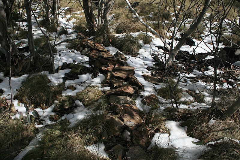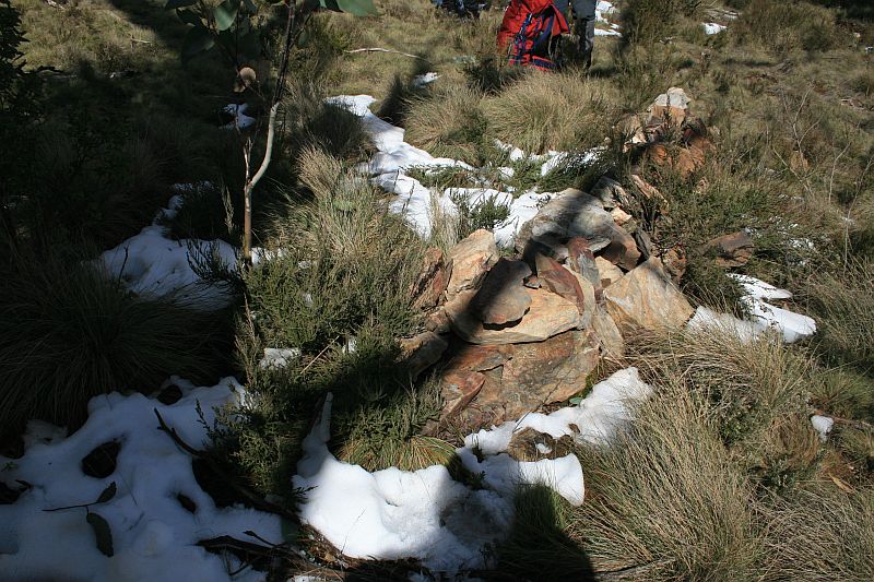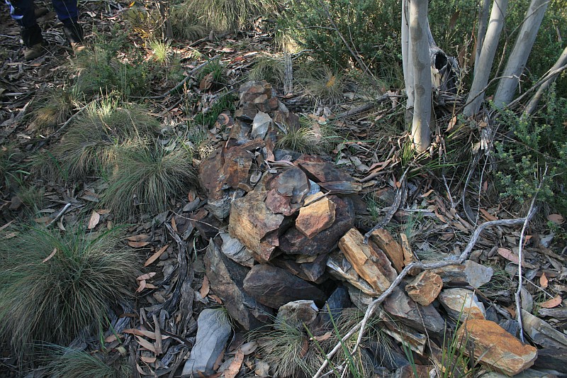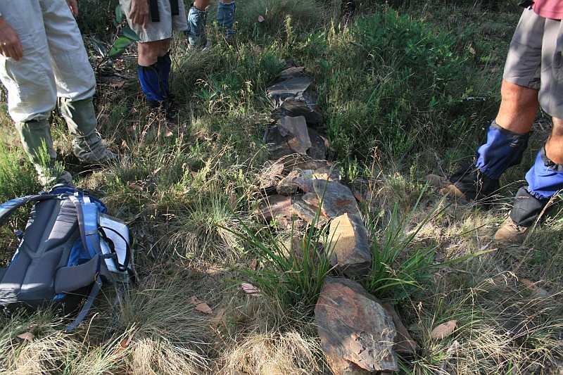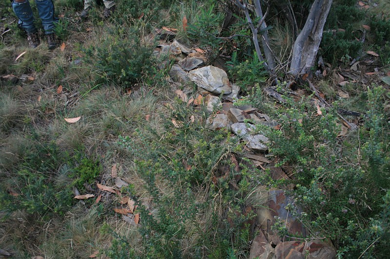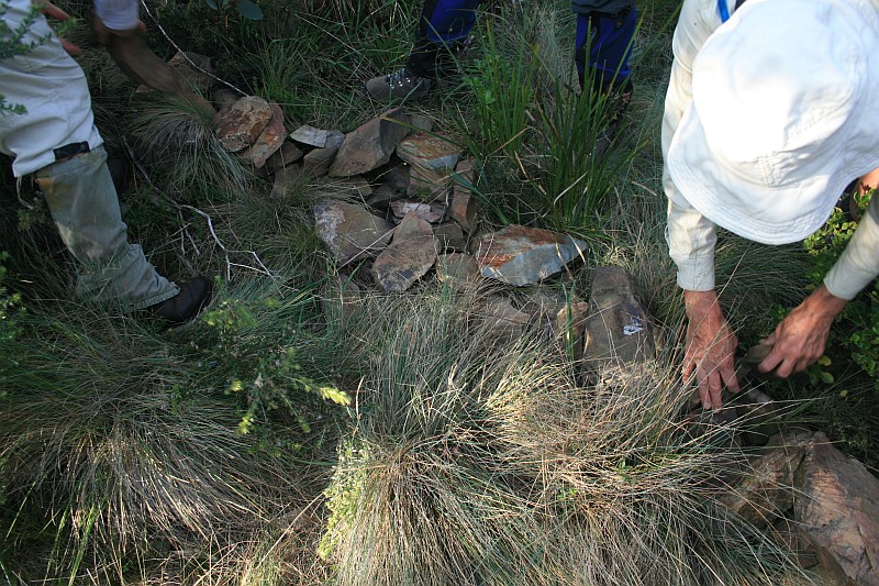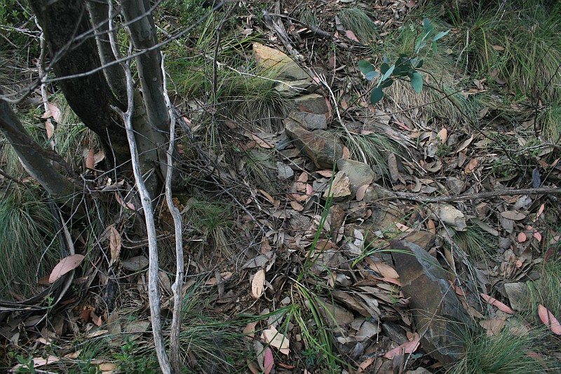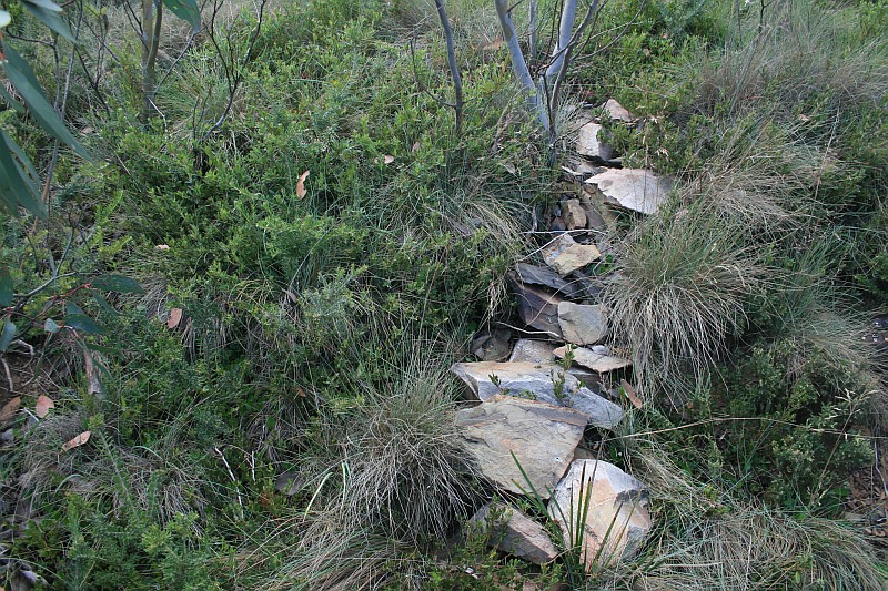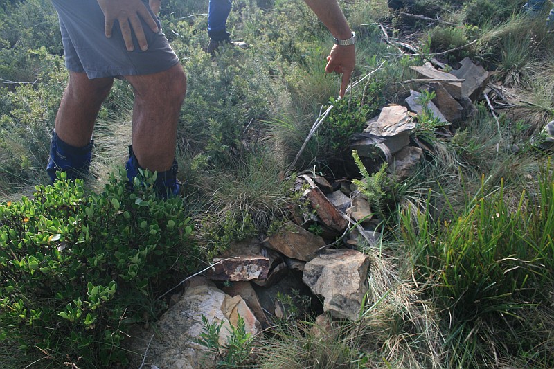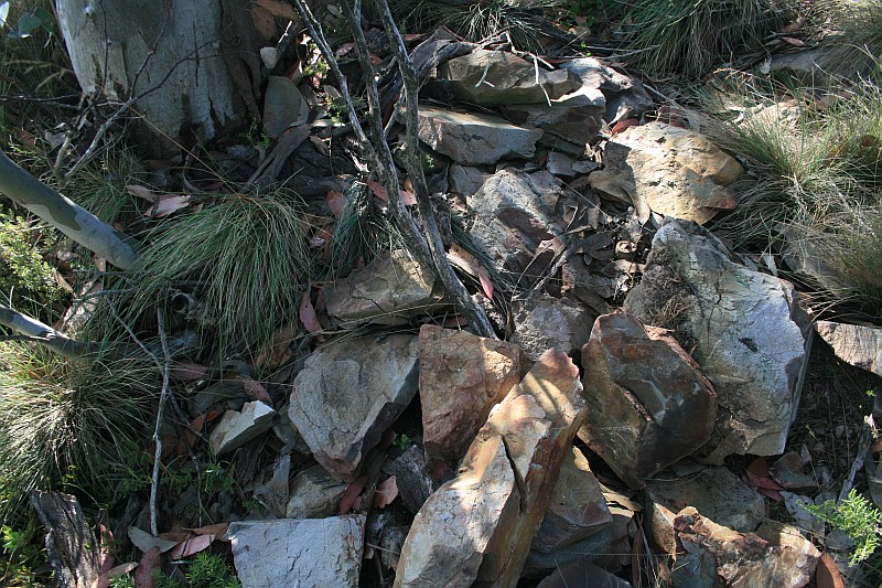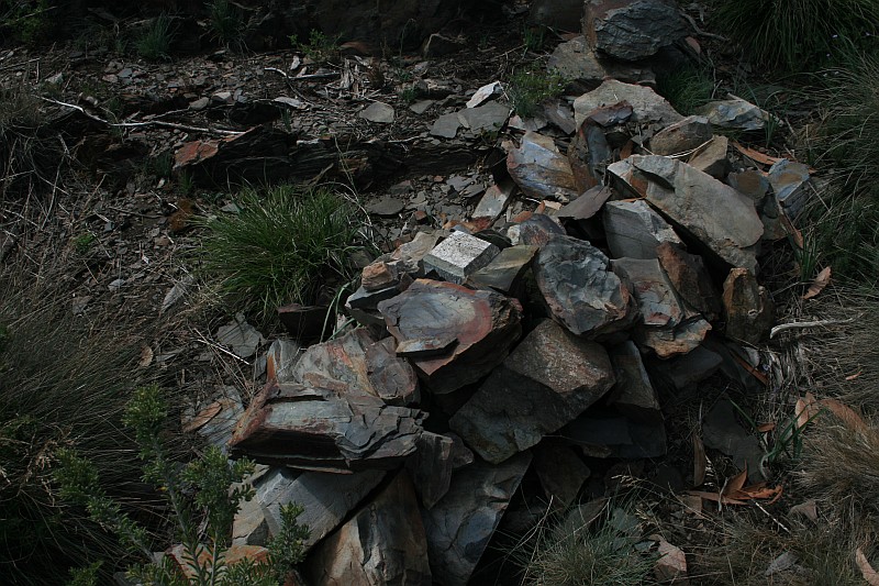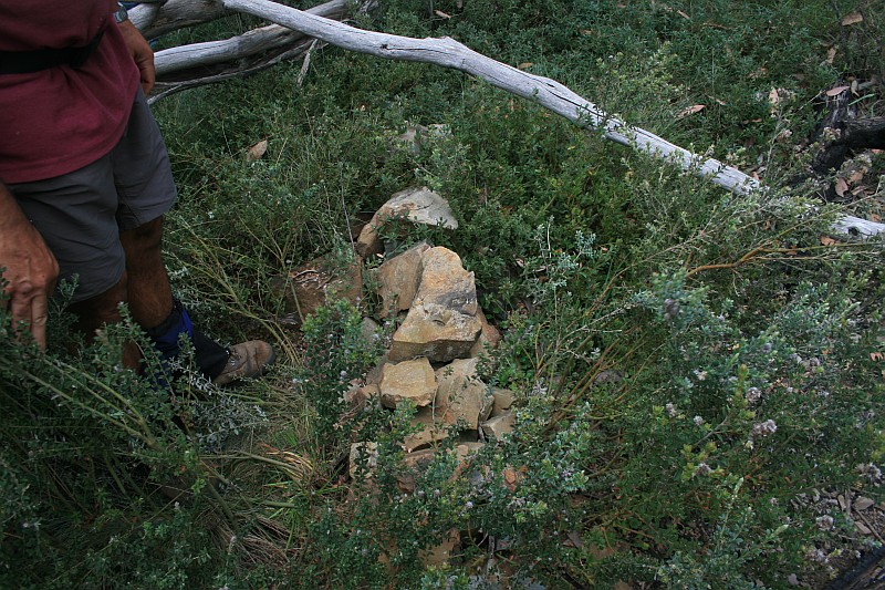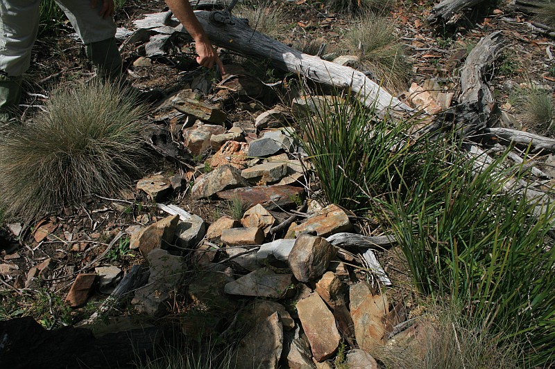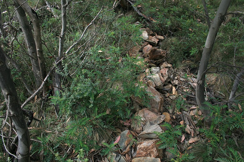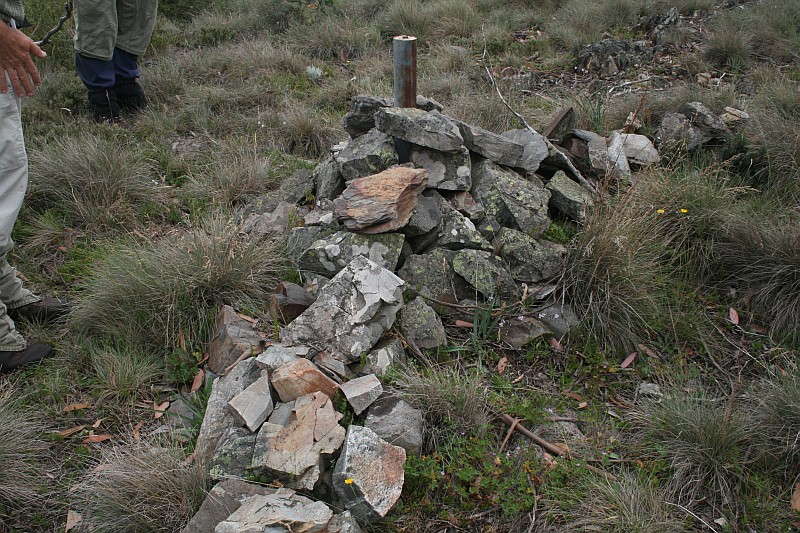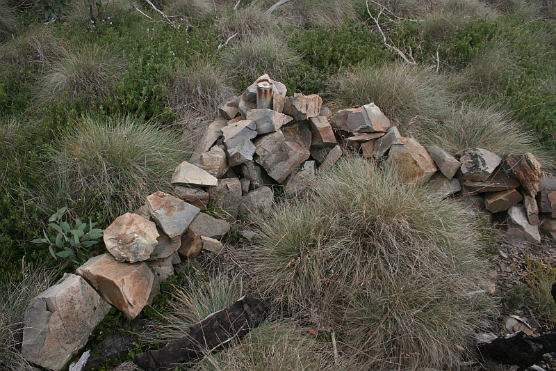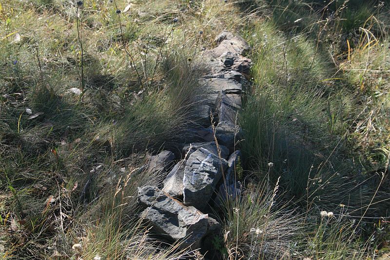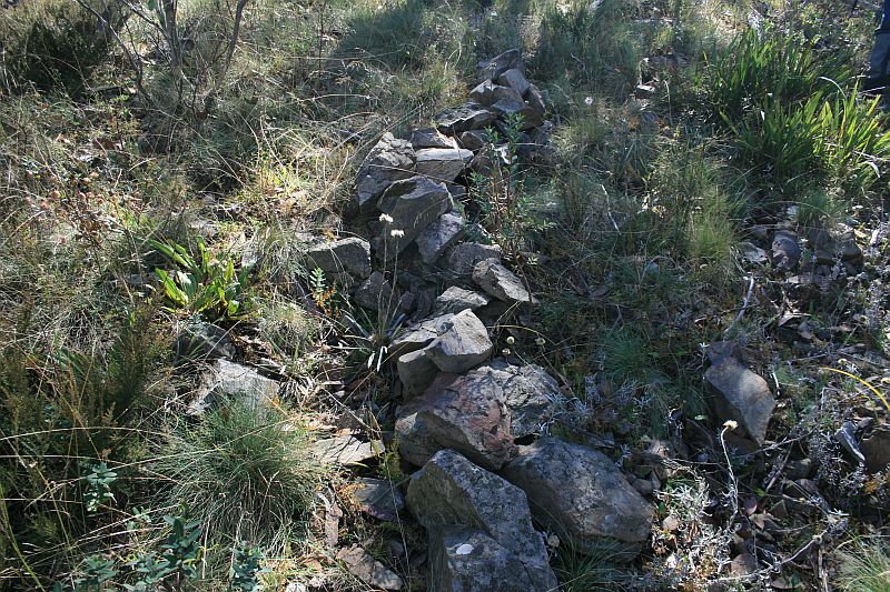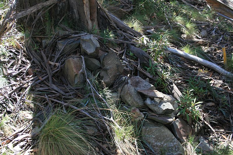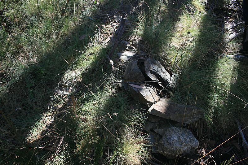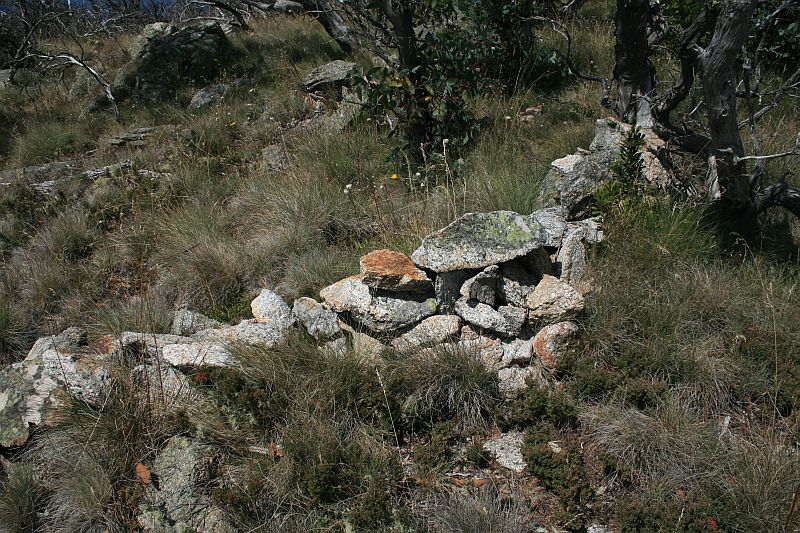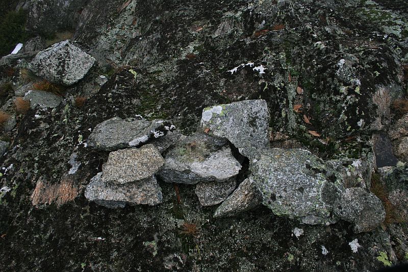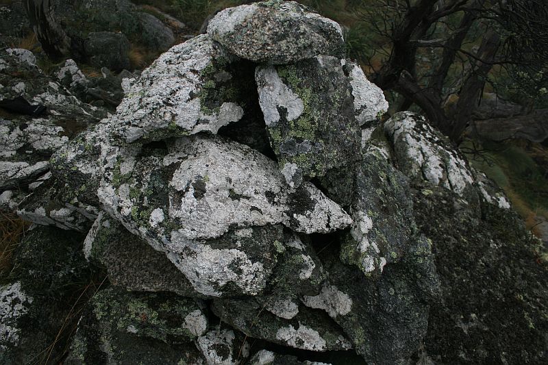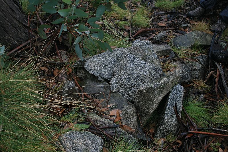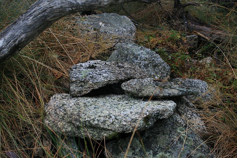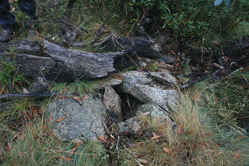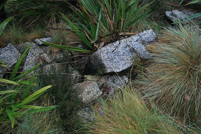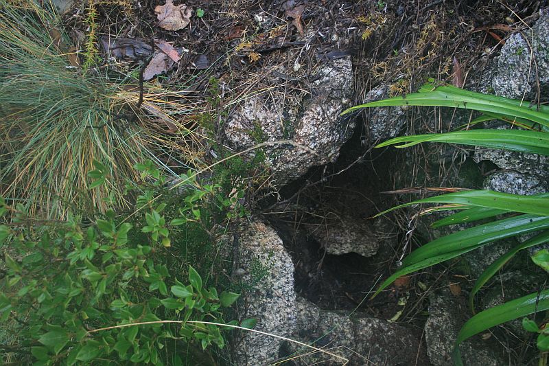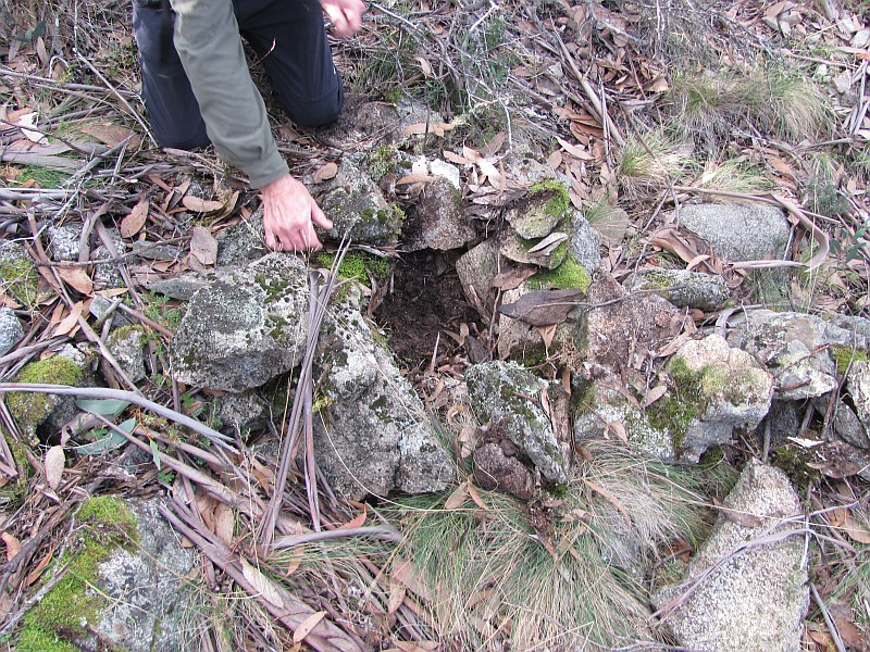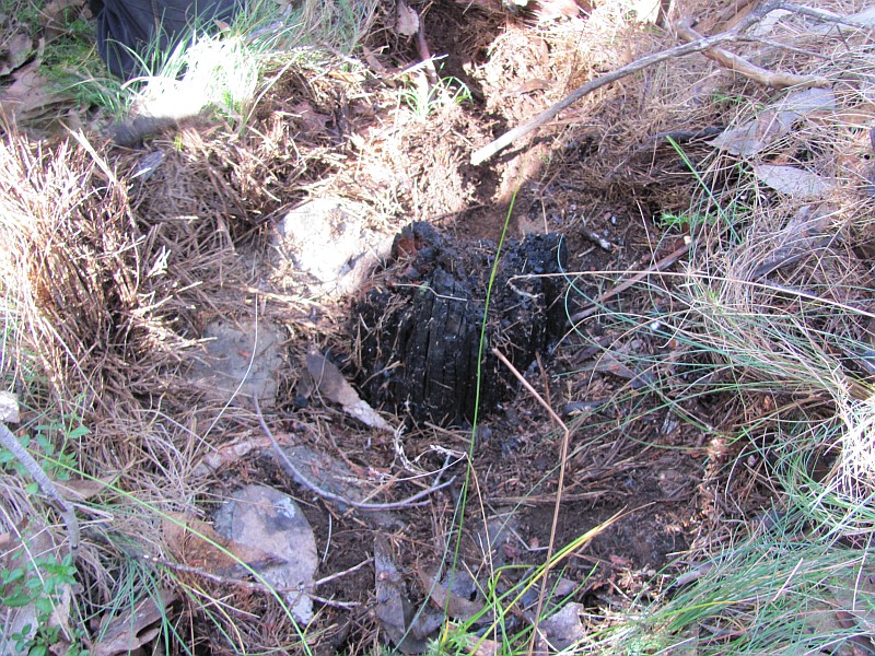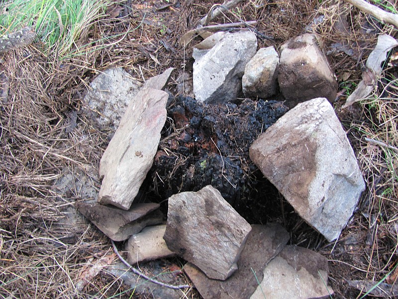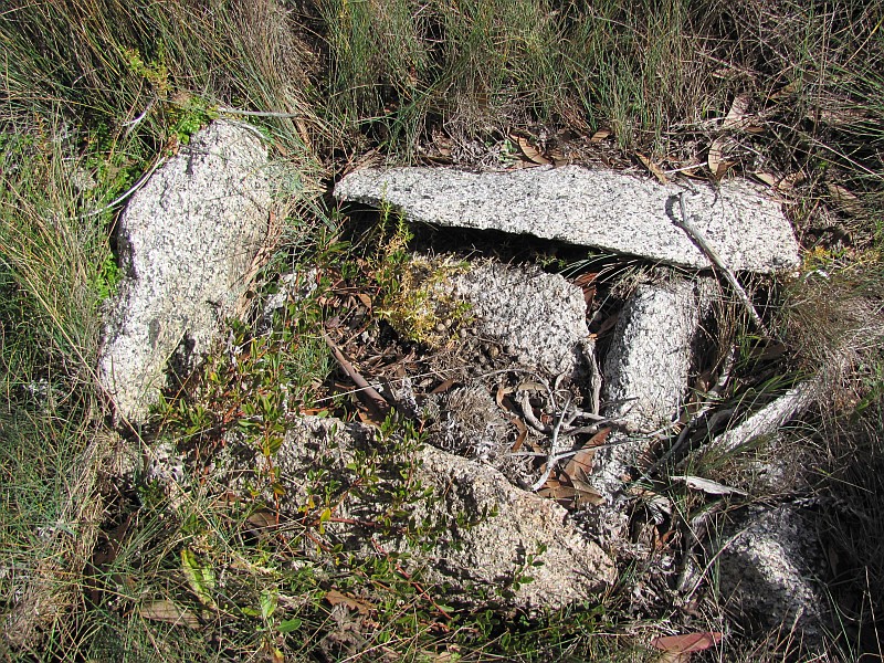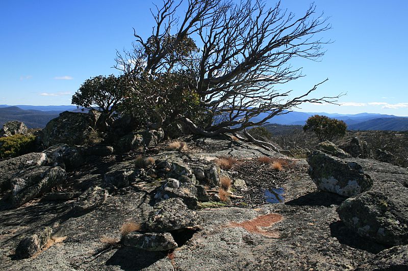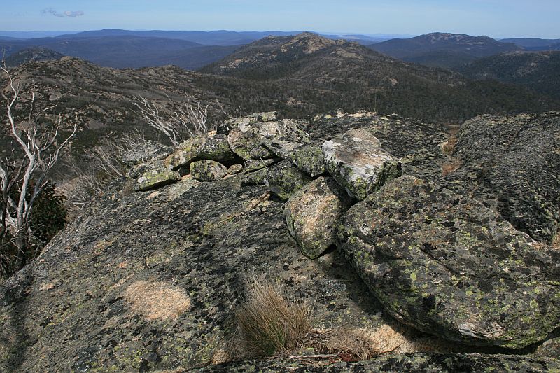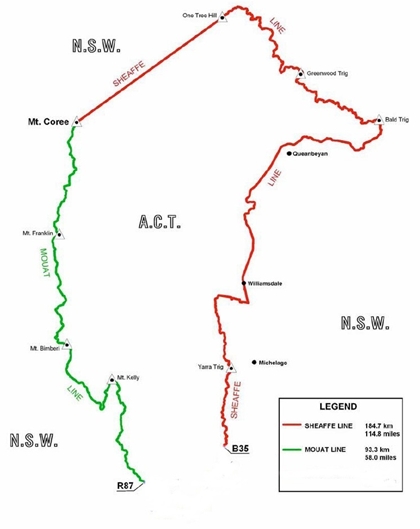
ACT-NSW Border Markers and Lockspits - the Moaut Line
This page last updated 23Mar14. Now at http://www.johnevans.id.au/wp/?page_id=3681
Mouat Line | Johnston Line | Sheaffe Line | Border Marker main page
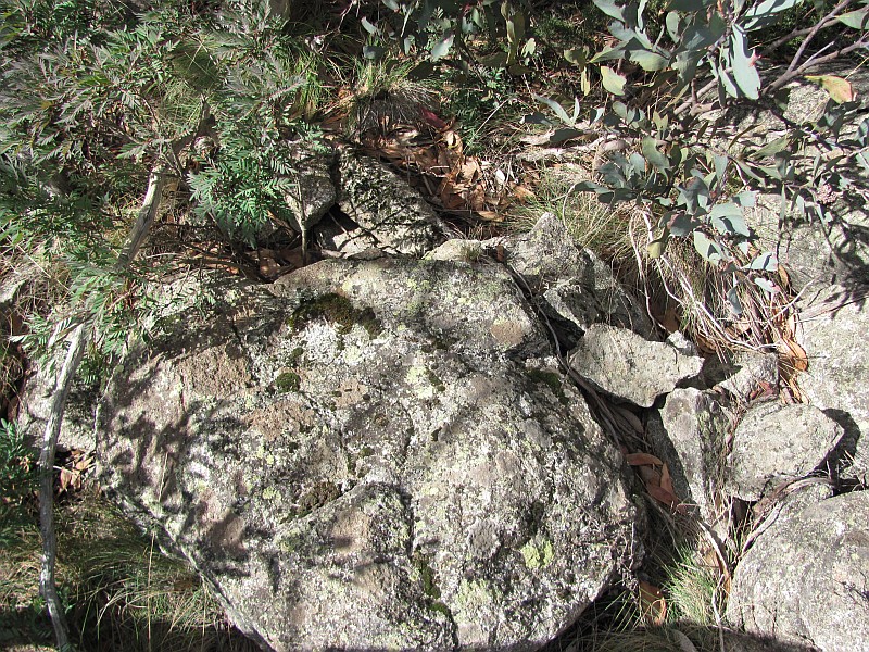
Border Markers from Mt Coree to Piccadilly Circus
Border markers in this area are covered in the
digitised original field book A 1008 - Coree to P51 - FC18 sheet 13 ![]() - (PDF 13.6 mb):
- (PDF 13.6 mb):
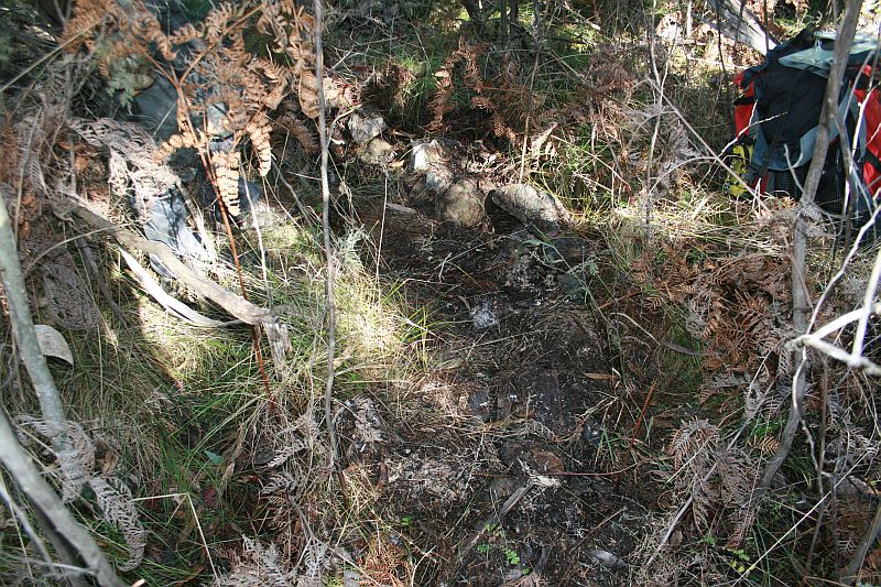
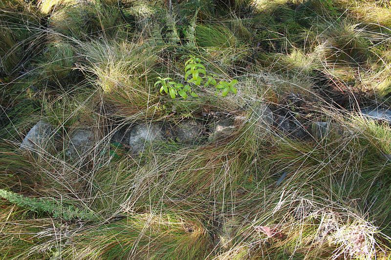
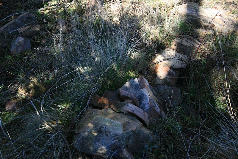
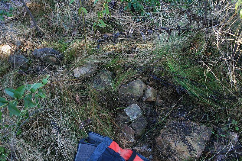
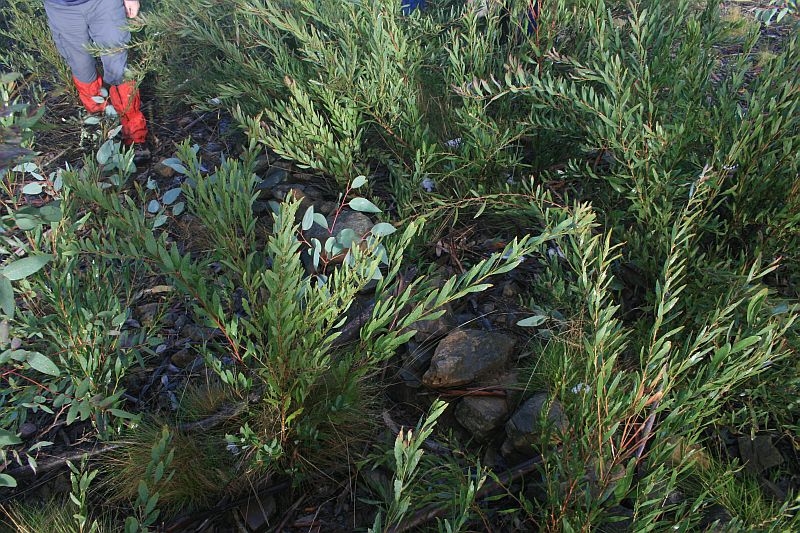
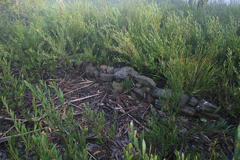
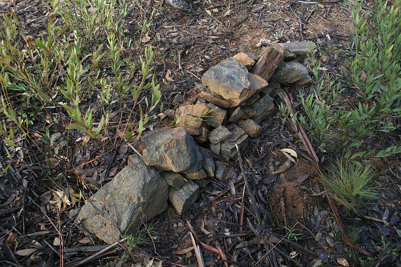
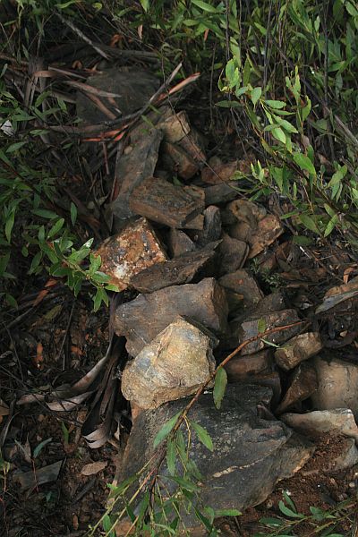
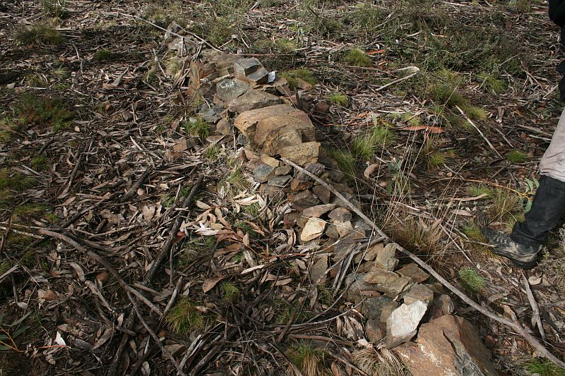
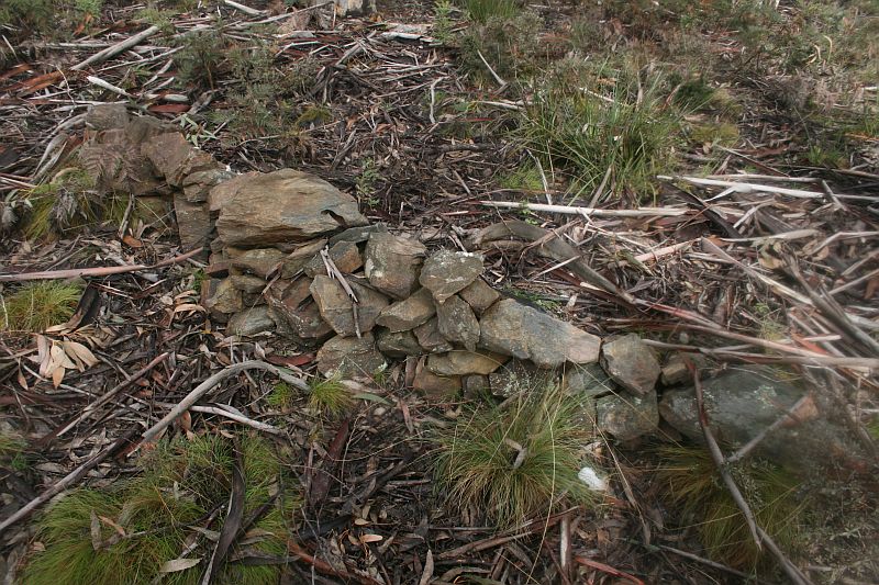
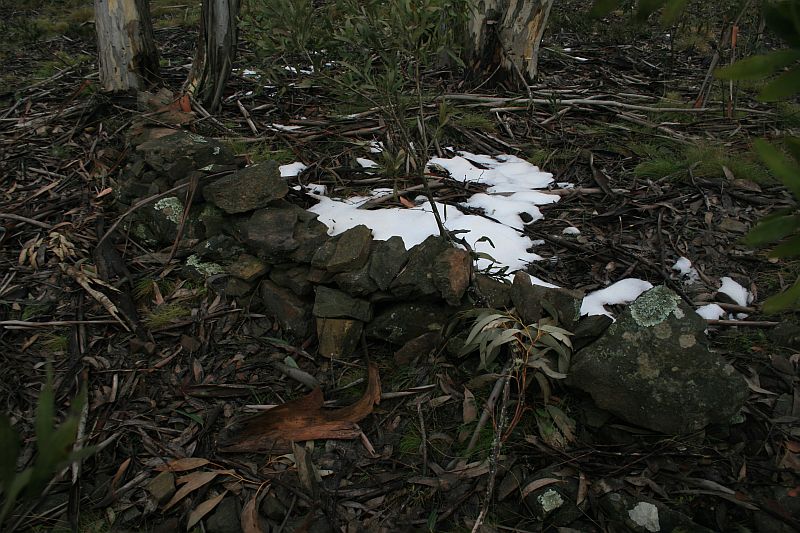
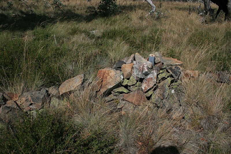
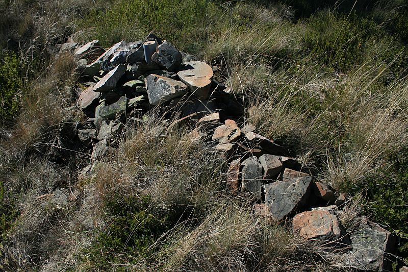
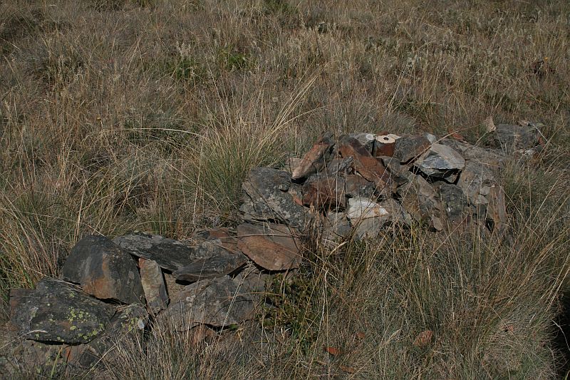
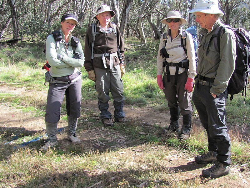
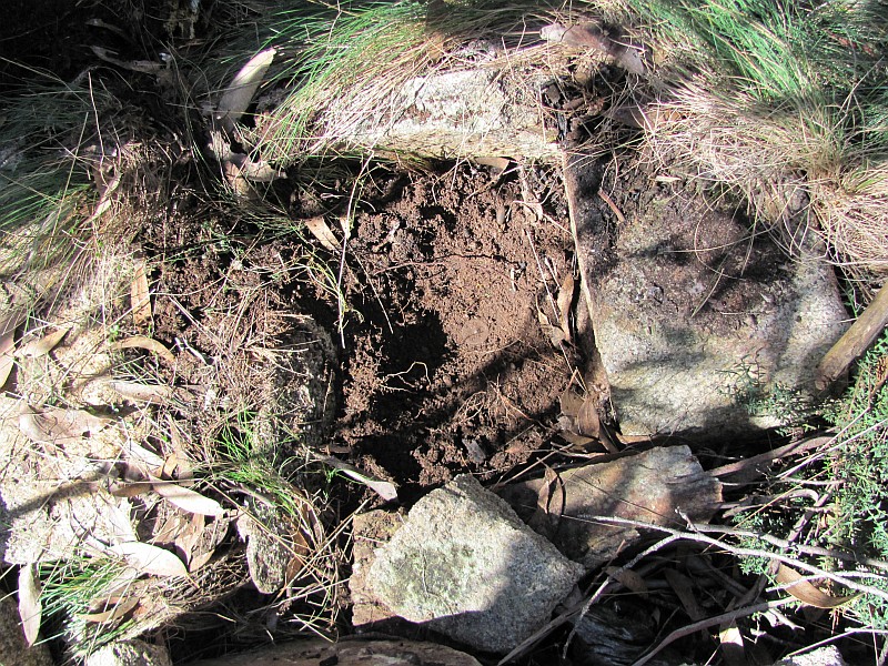
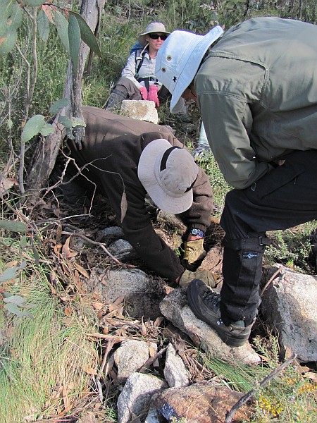
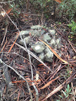
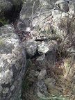
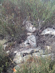
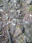
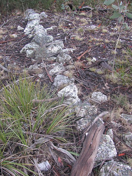
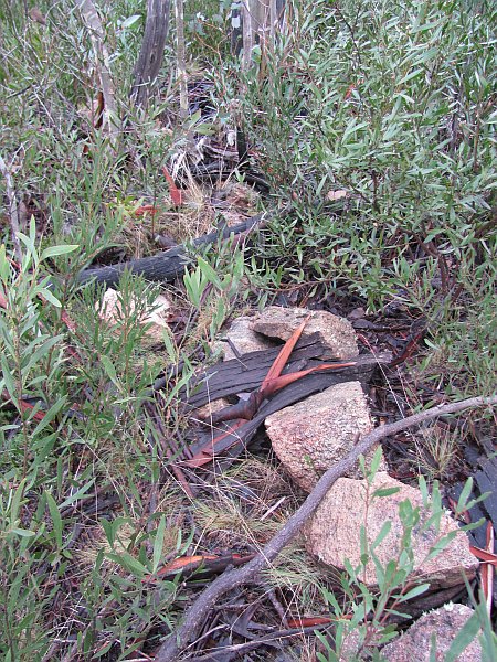
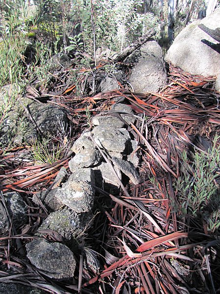
Border Marker No Survey Notes No Comment from Survey Notes5 Heritage Register Site No/Sourced from Matthew Higgins' field work3 ACTPLA Location
UTM4 55H (MGA)Visited - click on a date for a walk report Click on a thumbnail below
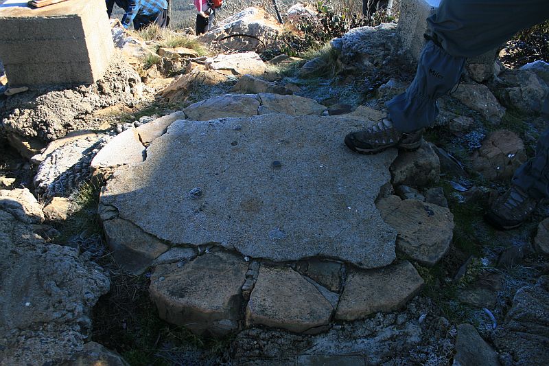
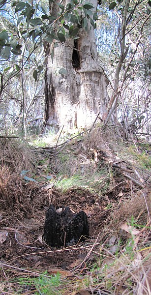
to see the full sized PictureCoree Coree Trig - 664566.702-6091358.403 25 May 10
7 Jul 09*A50a 1A 8" Post 1 664523.304-6091285.968 25 May 10
7 Jul 09*A50 1 8" Post 2 664364.367-6091102.740 7 Jul 09* B50 2 3 664348.428-6091034.659 7 Jul 09* C50 3 8" Post 4 664305.308-6090976.035 7 Jul 09* D50 4 8" Post 5 664272.264-6090900.468 7 Jul 09* E50 5 8" Post - 664114.168-6090562.552 possibly found
25 May 10
not found
7 Jul 09F50 6 8" Post - 663965.555-6090335.347 not found
7 Jul 09G50 7 8" Post - 663939.368-6090192.403 not found
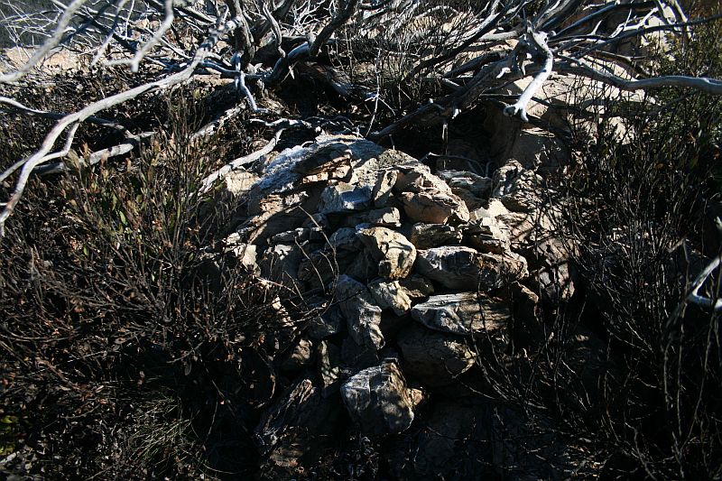
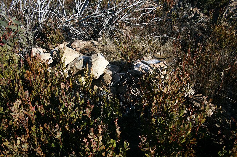
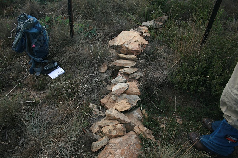
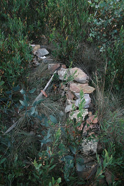
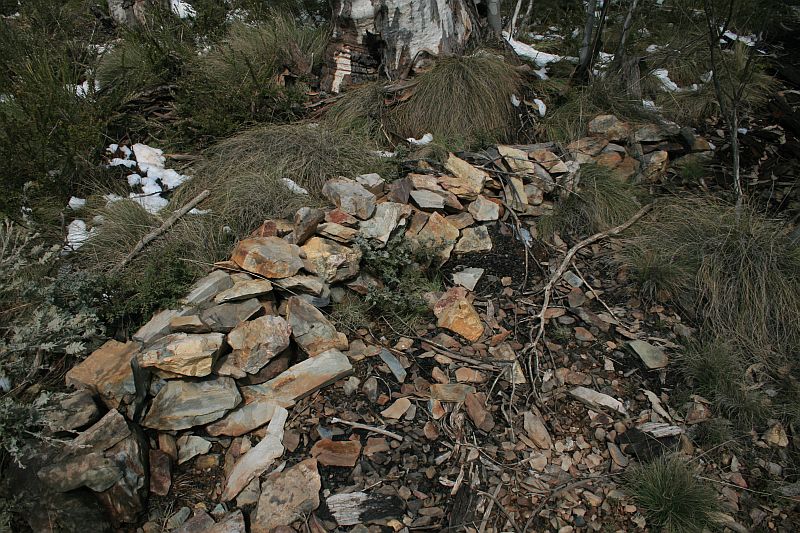
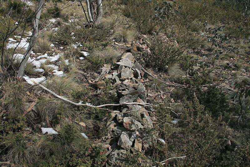
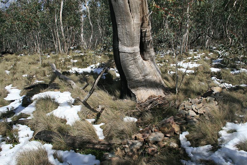
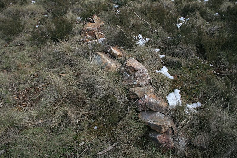
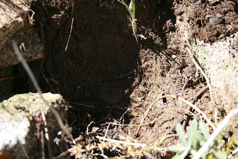
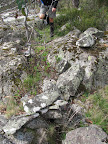
7 Jul 09H50 8 8" Post - 663878.325-6089998.344 7 Jul 09* 1 Mile Concrete block and bolt covered by cairn - 663839.616-6089948.172
(calculated)7 Jul 09* I50 9 8" Post - 663713.600-6089784.778 7 Jul 09* J50 10 8" Post - 663800.676-6089497.633 31 Jul 12
7 Jul 09*K50 11 8" Post - 663816.514-6089355.421 7 Jul 09* L50 12 8" Post - 663801.004-6089251.706 7 Jul 09* M50 13 8" Post - 663757.179-6088962.519 not found
31 Jul 12- N50 14 8" Post - 663634.918-6088819.737 31 Jul 12* O50 15 8" Post - 663459.775-6088644.486 31 Jul 12* 2 Mile Concrete block and bolt covered by cairn - 692881.392-6110915.510
(calculated)not found
31 Jul 12- P50 16 8" Post - 663378.865-6088453.103 31 Jul 12* Q50 17 8" Post - 663156.833-6088162.016 31 Jul 12* R50 18 8" Post 6 663071.919-6087978.181 31 Jul 12* S50 19 8" Post - 662994.960-6087872.623 31 Jul 12* T50 20 8" Post - 663166.292-6087557.731 not found
31 Jul 12
2 Feb 10in the black berries! U50 21 8" Post - 663211.731-6087366.273 31 Jul 12
2 Feb 10*V50 22 8" Post 7 663264.760-6087119.626 2 Feb 10* 3 Mile Concrete Block and Bolt covered by cairn 663271.567-6087100.299
(calculated)2 Feb 10* [1" Pipe in ground covered by cairn] 2 Feb 10* W50 23 8" Post - 663285.481-6087060.806 2 Feb 10* X50 24 8" Post - 663447.791-6086862.726 2 Feb 10* Y50 25 8" Post - 663494.709-6086615.487 2 Feb 10* Z50 26 8" Post 8 663497.951-6086280.534 2 Feb 10* A51 27 8" Post - 663482.231-6086180.461 2 Feb 10* B51 28 8" Post - 663428.552-6086029.435 2 Feb 10*
C51 29 8" Post - 663335.940-6085902.862 2 Feb 10* D51 30 8" Post - 663242.596-6085727.565 2 Feb 10* 4 Mile Concrete Block and Bolt covered by cairn 663346.457-6085700.778
(calculated)2 Feb 10* E51 31 12" Post set off 50 links square from centre of formation - 663500.857-6085660.977 2 Feb 10*
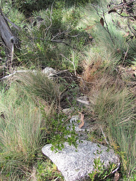
Border Markers from Piccadilly Circus to Bulls Head
Border markers in this area are covered in the
digitised original field books A 1008 - Coree to P51 - FC18 sheet 13 ![]() - (PDF 13.6 mb)
and A 1010 - P51 to B54 - FC18 sheet 13
- (PDF 13.6 mb)
and A 1010 - P51 to B54 - FC18 sheet 13 ![]() -
(PDF 13.3 mb):
-
(PDF 13.3 mb):
Border Marker No Survey Notes No Comment from Survey Notes5 Heritage Register Site No/Sourced from Matthew Higgins' field work3 ACTPLA Location
UTM4 55H (MGA)Visited - click on a date for a walk report Click on a thumbnail below
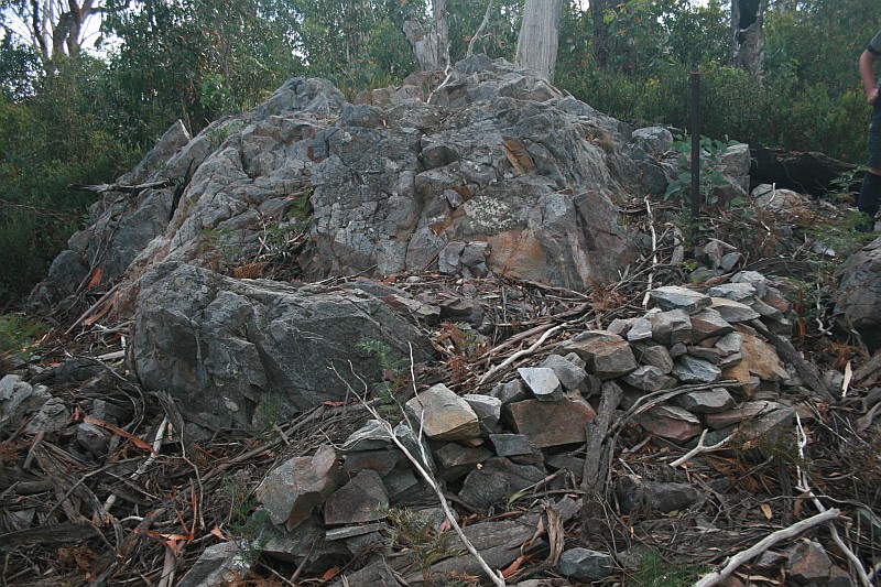
to see the full sized PictureF51 32 8" Post - 663610.435-6085513.716 2 Feb 10* G51 33 8" Post - 663602.835-6085358.107 2 Feb 10* H51 34 8" Post on Rocky Knob 8a 663669.339-6085254.231 2 Feb 10* I51 35 8" Post - 663831.445-6085186.702 2 Feb 10* Pipe 1" diam 15" long and cairn - 2 Feb 10* J51 36 8" Post - 663976.099-6085017.762 2 Feb 10* K51 37 8" Post - 664046.555-6084964.888 2 Feb 10* L51 38 8" Post - 664047.455-6084859.523 2 Feb 10* M51 39 8" Post - 663979.756-6084708.740 2 Feb 10* N51 40 8" Post - 663925.108-6084612.085 2 Feb 10* O51 41 8" Post - 663905.024-6084498.624 2 Feb 10* 5 Mile Concrete Block and Bolt Covered by Cairn - 663905.125-6084494.984
(calculated)2 Feb 10* P51 42 8" Post - 663907.959-6084393.420 2 Feb 10* Q51 43 8" Post - 663871.241-6084174.392 2 Feb 10* R51 44 8" Post - 663866.011-6083982.054 2 Feb 10* S51 45 8" Post - 663887.009-6083850.664 2 Feb 10* T51 46 8" Post - 663875.933-6083742.101 2 Feb 10* U51 47 8" Post - 663919.937-6083576.862 2 Feb 10* V51 48 8" Post - 663982.474-6083439.434 2 Feb 10* W51 49 8" Post - 664129.357-6083394.366 2 Feb 10* X51 50 8" Post - 664213.408-6083322.908 2 Feb 10* Y51 51 8" Post - 664281.848-6083239.661 2 Feb 10* Z51 52 8" Post - 664287.519-6083136.354 2 Feb 10* 6 Mile - Bolt in concrete block covered by cairn 664283.713-6083083.102
(calculated)4 Jan 11* A52 53 8" Post - 664280.719-6083041.141 2 Feb 10* B52 54 8" Post - 664208.035-6082985.944 4 Jan 11
2 Feb 10*C52 55 8" Post - 664041.293-6082867.789 4 Jan 11
2 Feb 10*D52 56 8" Post - 663923.594-6082752.976 4 Jan 11
2 Feb 10*
There is a survey line of points A52a, A52b, A52c and A52d to Bulls Head. We checked them out on 4 Jan 11, but found no markers at the locations.
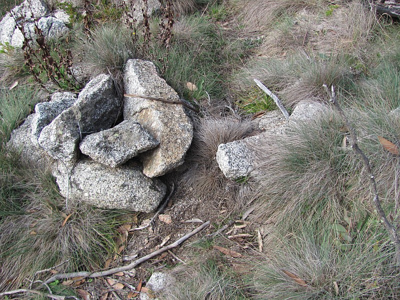
Border Markers from Bulls Head to Aggie Gap
Border markers in this area are covered in the digitised original field books A 1010 - P51 to B54 - FC18 sheet 13 ![]() -
(PDF 13.3 mb) and A 1011 - B54 to H55 - FC18 sheet 13
-
(PDF 13.3 mb) and A 1011 - B54 to H55 - FC18 sheet 13 ![]() -
(PDF 13.2 mb):
-
(PDF 13.2 mb):
Border Marker No Survey Notes No Comment from Survey Notes5 Heritage Register Site No/Sourced from Matthew Higgins' field work3 ACTPLA Location
UTM4 55H (MGA)Visited - click on a date for a walk report Click on a thumbnail below
to see the full sized PictureE52 57 8" Post - 663917.679-6082542.780 29 Sep 09* F52 58 8" Post - 663809.146-6082343.436 29 Sep 09*
19 Jan 05G52 59 8" Post - 663670.949-6082287.379 4 Jan 11
29 Sep 09*H52 60 8" Post - 663583.590-6082247.550 29 Sep 09* I52 61 8" Post - 663424.768-6082192.789 29 Sep 09* J52 62 8" Post - 663177.690-6082033.474 29 Sep 09* 7 Mile Concrete Pipe 3" and Cairn - 663156.370-6082002.383
(calculated)29 Sep 09* K52 63 8" Post - 663081.073-6081892.557 29 Sep 09* L52 64 8" Post - 663093.416-6081735.359 29 Sep 09* M52 65 8" Post - 663085.815-6081509.007 29 Sep 09* N52 66 8" Post - 663104.770-6081281.442 29 Sep 09* O52 67 8" Post - 663066.947-6081100.671 29 Sep 09* P52 68 8" Post - 663103.927-6080952.546 29 Sep 09* Q52 69 8" Post - 663074.524-6080843.046 29 Sep 09* R52 70 8" Post - 663120.002-6080688.108 29 Sep 09* S52 71 8" Post - 663093.447-6080566.616 29 Sep 09* 8 Mile Concrete Pipe 3" and Bolt covered by Cairn - 663096.786-6080515.501
(calculated)29 Sep 09* T52 72 8" Post - 663100.907-6080452.558 29 Sep 09* U52 73 8" Post - 663079.887-6080379.799 29 Mar 11
29 Sep 09*V52 74 8" Post - 663018.462-6080329.684 29 Sep 09* W52 75 8" Post - 662764.910-6080301.811 29 Sep 09* X52 76 8" Post - 662553.768-6080247.401 29 Sep 09* Y52 77 8" Post - 662381.253-6080216.658 29 Sep 09* Z52 78 8" Post - 662306.957-6080180.489 29 Sep 09*
19 Jan 05A53 79 8" Post - 662150.677-6080144.338 29 Sep 09* B53 80 8" Post - 662145.600-6079947.905 29 Sep 09* C53 81 8" Post - 662187.611-6079713.158 29 Sep 09* 9 Mile Concrete Pipe 3" and Bolt covered by Cairn - 662218.287-6079656.560
(calculated)29 Sep 09* D53 82 8" Post - 662268.798-6079563.405 29 Sep 09* E53 83 8" Post - 662408.799-6079488.697 29 Sep 09* F53 84 8" Post - 662533.377-6079389.624 29 Sep 09* G53 85 8" Post - 662490.682-6079237.281 29 Sep 09* H53 86 8" Post - 662416.851-6079130.332 29 Sep 09* I53 87 8" Post - 662449.709-6078950.009 29 Sep 09* J53 88 8" Post - 662408.970-6078791.286 29 Sep 09* K53 89 8" Post - 662404.623-6078677.328 29 Sep 09* L53 90 8" Post - 662287.008-6078556.571 29 Sep 09* M53 91 8" Post - 662349.450-6078373.401 29 Sep 09* 10 Mile Concrete Pipe 3" and Bolt covered by Cairn - 662360.467-6078300.695
(calculated)29 Mar 11* N53 92 8" Post - 662368.516-6078247.638 29 Sep 09* O53 93 8" Post - 662398.893-6078188.716 29 Sep 09* P53 94 8" Post - 662345.128-6078142.669 29 Sep 09* Q53 95 8" Post - 662254.308-6078072.544 29 Sep 09* R53 96 8" Post 9 662148.136-6077914.014 29 Sep 09* S53 97 8" Post - 662065.295-6077764.985 29 Sep 09* T53 98 8" Post - 662040.455-6077632.042 29 Sep 09* U53 99 8" Post - 661959.371-6077544.419 29 Sep 09* V53 100 8" Post - 661899.677-6077506.236 29 Sep 09* W53 101 8" Post - 661668.939-6077442.471 29 Sep 09* X53 102 8" Post - 661597.362-6077235.791 29 Sep 09* 11 Mile Concrete Pipe and Bolt covered by cairn 10 661517.928-6077098.724
(calculated)12 Apr 11
29 Sep 09*
11 Mile survey blaze Marked with 45, broad arrow, R, M, 11 10 661535.565-6077101.799
(calculated)12 Apr 11
2 May10*Y53 103 8" Post - 661448.378-6076978.699 29 Sep 09* Z53 104 8" Post - 661354.407-6076704.470 29 Sep 09* A54 105 8" Post - 661090.353-6076510.297 29 Sep 09* B54 106 8" Post - 661041.591-6076257.955 29 Sep 09* C54 107 8" Post 11 661059.858-6076039.404 29 Sep 09* D54 108 8" Post 12 661030.454-6075941.751 12 Apr 11
29 Sep 09*E54 109 8" Post 13 660991.951-6075860.523 29 Sep 09* 12 Mile 3" Concrete Pipe covered by cairn - 660920.728-6075690.629
(calculated)29 Sep 09* F54 110 8" Post 14 660909.277-6075663.302 29 Sep 09* G54 111 8" Post - 660972.296-6075424.062 29 Sep 09* H54 112 8" Post - 661048.091-6075290.058 29 Sep 09* I54 113 8" Post - 661090.632-6075153.033 29 Sep 09* J54 114 8" Post 15 661168.238-6075060.604 29 Sep 09* K54 115 8" Post - 661068.135-6074932.511 29 Sep 09* L54 116 8" Post - 661043.963-6074751.464 29 Sep 09* M54 117 8" Post 16 660929.595-6074584.178 29 Sep 09* N54 118 8" Post - 660884.993-6074467.814 29 Sep 09* O54 119 8" Post - 660858.761-6074399.995 29 Sep 09* P54 120 8" Post 17 660871.151-6074233.354 29 Sep 09* 13 Mile Concreted 3" Dowpipe covered by cairn 18 660870.293-6074232.432
(calculated)29 Sep 09* Q54 121 8" Post 19 660760.729-6074114.844 29 Sep 09* R54 122 8" Post 20 660626.526-6074076.900 29 Sep 09* S54 123 8" Post 21 660515.852-6073960.294 29 Sep 09* T54 124 8" Post, Old peg found and renewed (Mt Aggie) - 660345.485-6073898.496 29 Sep 09* U54 125 8" Post 22 660304.885-6073711.992 29 Sep 09* V54 126 8" Post 23 660310.845-6073515.883 29 Sep 09* W54 127 8" Post - 660309.879-6073350.596 29 Sep 09* X54 128 8" Post - 660306.397-6073266.571 29 Sep 09* Y54 129 8" Post - 660423.361-6073123.069 29 Sep 09* 14 Mile Concrete Pipe & Cairn - not seen
29 Sep 09Z54 130 8" Post - 660526.011-6072915.241 not seen
16 Jan 10
29 Sep 09
Border Markers from Aggie Gap to Mt Ginini
Border markers from Aggie Gap to Mt Ginini are
covered in the digitised original field books A 1011 - B54 to H55 - FC18 sheet 13 ![]() -
(PDF 13.2 mb), A 1013 - H55 to R56 - FC18 sheet 12, 13
-
(PDF 13.2 mb), A 1013 - H55 to R56 - FC18 sheet 12, 13 ![]() - (PDF 13.0 mb)
and A 1022 - Q56 to P58 - FC18 sheet 12
- (PDF 13.0 mb)
and A 1022 - Q56 to P58 - FC18 sheet 12 ![]() - (PDF 12.7 mb):
- (PDF 12.7 mb):
Border Marker No Survey Notes No Comment from Survey Notes5 Heritage Register Site No/Sourced from Matthew Higgins' field work3 ACTPLA Location
UTM4 55H (MGA)Visited - click on a date for a walk report Click on a thumbnail below
to see the full sized PictureA55 131 8" Post - 660634.744-6072771.248 16 Jan 10* B55 132 8" Post 24 660621.884-6072612.112 16 Jan 10* C55 133 8" Post - 660600.632-6072445.802 16 Jan 10* D55 134 8" Post - 660651.301-6072276.719 16 Jan 10* E55 135 8" Post - 660746.134-6072120.433 16 Jan 10* F55 136 8" Post - 660841.476-6071987.624 16 Jan 10* G55 137 8" Post - 660897.717-6071857.197 16 Jan 10* H55 138 1" Pipe 15" long filled with concrete - 660970.854-6071720.335 16 Jan 10* I55 139 8" Post 25 660970.276-6071652.634 16 Jan 10*
15 Mar 06*
J55 140 8" Post - 660960.292-6071596.011 16 Jan 10* K55 141 8" Post - 660911.526-6071564.370 16 Jan 10* 15 Mile 3" Concrete Pipe and 3" Stake - 660901.439-6071560.338
(calculated)16 Jan 10* L55 142 8" Post - 660850.794-6071540.093 16 Jan 10* M55 143 1" Pipe covered by cairn 25a 660729.450-6071464.885 16 Jan 10* N55 144 1" Pipe covered by cairn - 660640.112-6071411.319 16 Jan 10* O55 145 8" Post 25b 660545.283-6071405.759 16 Jan 10* P55 146 8" Post - 660445.587-6071312.680 16 Jan 10* Q55 147 8" Post - 660284.166-6071212.155 16 Jan 10* R55 148 8" Post - 660116.583-6071083.965 16 Jan 10* S55 149 8" Post 26 660054.536-6070976.555 16 Jan 10* T55 150 8" Post 27 659977.064-6070789.981 16 Jan 10* U55 151 8" Post - 659890.186-6070577.339 16 Jan 10* 16 Mile 3" Concrete Pipe and Cairn 28 659901.912-070458.979
(calculated)16 Jan 10* V55 152 8" Post 29 659902.130-6070456.783 16 Jan 10* W55 153 8" Post - 659997.936-6070307.624 16 Jan 10* X55 154 8" Post - 660029.757-6070115.887 16 Jan 10* Y55 155 8" Post 30 660011.505-6069919.980 16 Jan 10* Z55 156 8" Post - 660017.420-6069726.098 16 Jan 10* A56 157 1" Pipe covered by cairn 31 660088.326-6069489.671 16 Jan 10* B56 158 1" Pipe covered by cairn 32 660242.251-6069349.768 16 Jan 10* C56 159 8" Post 33 660324.796-6069285.937 16 Jan 10* D56 160 3" Downpipe with Concrete Core and bolt surrounded by cairn 34 660366.421-6069150.872 16 Jan 10* 17 Mile Concrete Post and Bolt Covered by Cairn 35 660281.393-069035.164
(calculated)16 Jan 10* E56 3" Concreted Downpipe and Bolt Covered by cairn 36 660155.328-6068863.616 16 Jan 10* F56 8" Post - 660238.531-6068738.217 16 Jan 10* G56 8" Post 37 660258.765-6068581.793 16 Jan 10* H56 8" Post 38 660239.160-6068468.023 16 Jan 10* I56 165 8" Post 39 660223.617-6068370.249 16 Jan 10
18 Apr 09*J56 166 8" Post - 660244.726-6068203.038 18 Apr 09* K56 167 8" Post - 660248.633-6067996.535 18 Apr 09* L56 168 8" Post - 660268.127-6067831.546 18 Apr 09* M56 169 8" Post - 660311.626-6067675.390 18 Apr 09* 18 Mile Concrete Pipe 3" and Bolt Covered by Cairn 40 177977.622-577013.912
(ACT grid2 from annotated 1:16000 map segment)
= 660283-6067507 (MGA)
660283.484-6067507.932
(calculated)18 Apr 09* N56 170 8" Post - 660276.770-6067467.983 18 Apr 09* O56 171 8" Post - 660301.638-6067298.845 18 Apr 09* P56 172 1" Pipe covered by cairn - 660447.303-6067109.406 18 Apr 09* Q56 173 1" Pipe covered by cairn 41 660565.979-6066935.094 18 Apr 09* R56 174 8" Post - 660613.073-6066856.985 18 Apr 09* S56 175 3" Downpipe with Concrete Core Surrounded by Cairn
(Annotated GONE on 1:16000 map segment)- 660651.912-6066805.781 18 Apr 09* T56 176 8" Post 42 660679.701-6066751.417 18 Apr 09*
Border Markers from Mt Ginini to Stockyard Gap
Border markers in this area are also covered in the digitised original field book A 1022 - Q56 to P58 - FC18 sheet 12 ![]() - (PDF 12.7 mb). There are a total of
14 border markers located on the southern spur of Mt Ginini, down
the old cleared ski slope and into the bush, defining the border over the little
knoll and down to Stockyard Gap. Again, with the accurate ACTPLA data (to one
thousandth of a metre!), it was a relative breeze to find them all:
- (PDF 12.7 mb). There are a total of
14 border markers located on the southern spur of Mt Ginini, down
the old cleared ski slope and into the bush, defining the border over the little
knoll and down to Stockyard Gap. Again, with the accurate ACTPLA data (to one
thousandth of a metre!), it was a relative breeze to find them all:
Border Marker No Survey Notes No Comment from Survey Notes5 Heritage Register Site No/Sourced from Matthew Higgins' field work3 ACTPLA Location
UTM4 55H (MGA)Visited - click on a date for a walk report Click on a thumbnail below
to see the full sized PictureU56 177 8" Post - 660671.981 6066588.743 18 Apr 09* V56 178 8" Post - 660622.635 6066388.089 18 Apr 09* W56 179 8" Post 43 660577.006 6066243.206 18 Apr 09* X56 180 3" Downpipe and Cairn 44 660488.908-6066066.701 30 Apr 11
5 Feb 11
18 Apr 09
21 Mar 09*19 Mile 3" Downpipe with Concrete Core Surrounded by cairn 45 178212.409-575576.831
(ACT grid2 from annotated 1:16000 map segment)
= 660488-6066066 (MGA)
660485.759-6066054.973
(calculated)30 Apr 11
5 Feb 11
18 Apr 09*Y56 181 3" Downpipe Concrete Core and Cairn 46 660461.111-6065963.023 18 Apr 09
21 Mar 09*Z56 182 3" Downpipe with Concrete Core and Cairn 47 660440.924-6065836.043 18 Apr 09
21 Mar 09*A57 183 8" Post - 660448.344-6065591.059 5 Feb 11
18 Apr 09
21 Mar 09*B57 184 8" Post 70 links W of knob, 6' below absolute shed - 660437.086-6065407.845 5 Feb 11
18 Apr 09*C57 185 8" Post - 660419.407-6065339.071 5 Feb 11
18 Apr 09*D57 186 8" Post - 660394.483-6065220.821 18 Apr 09* E57 187 none - 660417.182-6065143.347 18 Apr 09* F57 188 none - 660444.236-6065010.444 18 Apr 09* G57 189 none - 660568.178-6064812.325 18 Apr 09*
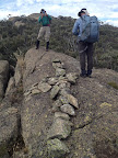
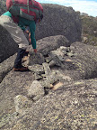
Border Markers on Little Ginini Mountain
This length of the border stretches from
Stockyard Gap south up over Little Ginini Mountain then down to Pryors Hut. Border markers in this area are covered in the digitised original field book A 1022 - Q56 to P58 - FC18 sheet 12 ![]() - (PDF 12.7 mb). There are 10 border
markers. As the pics show, all these have been visited. The only doubtful one is
H57 and, having been there looking twice, I reckon it must have been bulldozed:
- (PDF 12.7 mb). There are 10 border
markers. As the pics show, all these have been visited. The only doubtful one is
H57 and, having been there looking twice, I reckon it must have been bulldozed:
Border Marker No Survey Notes No Comment from Survey Notes5 Heritage Register Site No/Sourced from Matthew Higgins' field work3 ACTPLA Location
UTM4 55H (MGA)Visited - click on a date for a walk report Click on a thumbnail below
to see the full sized PictureH57 190 none - 660731.465-6064639.694
only a marker peg up on the side of the road found. Suspect BM has been bulldozed18 Apr 09* 20 Mile Concrete Pipe and Cairn - 178509.320-574093.041
(ACT grid2 from annotated 1:16000 map segment)
= 660755-6064577 (MGA)
660759.068-6064568.021
(calculated)14 Apr 09* I57 191 none - 660805.655-6064447.142 14 Apr 09* J57 192 none - 660856.194-6064296.517 14 Apr 09* K57 193 none - 660903.202-6064161.837 14 Apr 09* L57 194 1" Pipe - 660918.233-6064014.285 14 Apr 09* M57 195 Pipe - 660980.431-6063947.355 30 Apr 11
5 Feb 11
14 Apr 09*M57 blaze - - 660991.657-6063947.031
(calculated)30 Apr 11* N57 196 none - 661045.705-6063797.508 14 Apr 09* O57 197 3" Downpipe Concrete Core & Cairn - Station on knob Shist [sic] outcrop 48 661090.908-6063718.545 30 Apr 11
5 Feb 11
14 Apr 09*P57 198 Downpipe and Cairn 49 661139.196-6063562.184 30 Apr 11
5 Feb 11
14 Apr 09*
Border Markers around Pryors Hut
Border markers in this area are covered in the
digitised original field book A 1022 - Q56 to P58 - FC18 sheet 12 ![]() - (PDF 12.7 mb). Page 10b of the
notebook (page 14 of the pdf file) shows the sketch of the area and page 11a
(page 15 of the pdf) contains the survey data for Q57. Another marker, 191.78
links from Q57, unidentified except for the description '3" Concrete Downpipe
and Mound', is the 21 Mile marker. I deduced this from the fact that the
unidentified marker 60.31 links from X56 (see page 3b of the notebook) had a
nearby blaze which included M19; the ACT Heritage Listing has entry 44 X56 and
entry 45 19 Mile at the same location 604658; summing the distances between
markers from 19 Mile to the marker near G57 gives 2 miles. These can both be
found just S of Pryors Hut, on the W side of the Mt Franklin Road. This is where
and how the border marker fetish started:
- (PDF 12.7 mb). Page 10b of the
notebook (page 14 of the pdf file) shows the sketch of the area and page 11a
(page 15 of the pdf) contains the survey data for Q57. Another marker, 191.78
links from Q57, unidentified except for the description '3" Concrete Downpipe
and Mound', is the 21 Mile marker. I deduced this from the fact that the
unidentified marker 60.31 links from X56 (see page 3b of the notebook) had a
nearby blaze which included M19; the ACT Heritage Listing has entry 44 X56 and
entry 45 19 Mile at the same location 604658; summing the distances between
markers from 19 Mile to the marker near G57 gives 2 miles. These can both be
found just S of Pryors Hut, on the W side of the Mt Franklin Road. This is where
and how the border marker fetish started:
Border Marker No Survey Notes No Comment from Survey Notes5 Heritage Register Site No/Sourced from Matthew Higgins' field work3 ACTPLA Location
UTM4 55H (MGA)Visited - click on a date for a walk report Click on a thumbnail below
to see the full sized PictureQ57 199 none - 661181.304-6063005.333 30 Apr 11
5 Feb 11
12 Jun 10
19 May 09
14 Apr 09
21 Mar 09*
17 Mar 0921 Mile 3" Concrete Downpipe and Mound - 178963.???-572568.???
(ACT grid2 from annotated 1:16000 map segment)
= 661180-6063043 (MGA)
661178.392-6063043.591
(calculated)5 Feb 11
12 Jun 10
19 May 09
14 Apr 09
21 Mar 09*
17 Mar 09
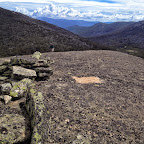
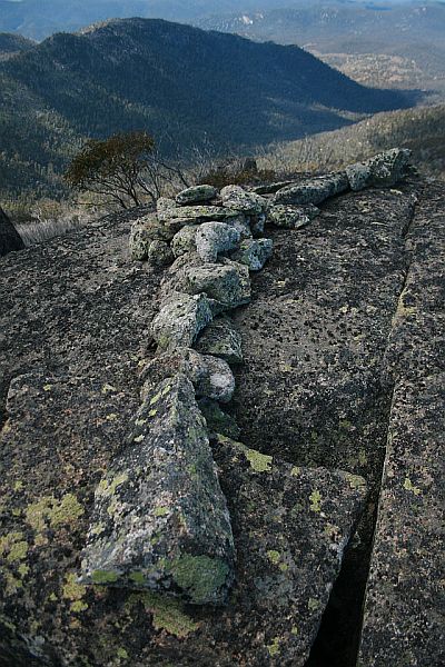
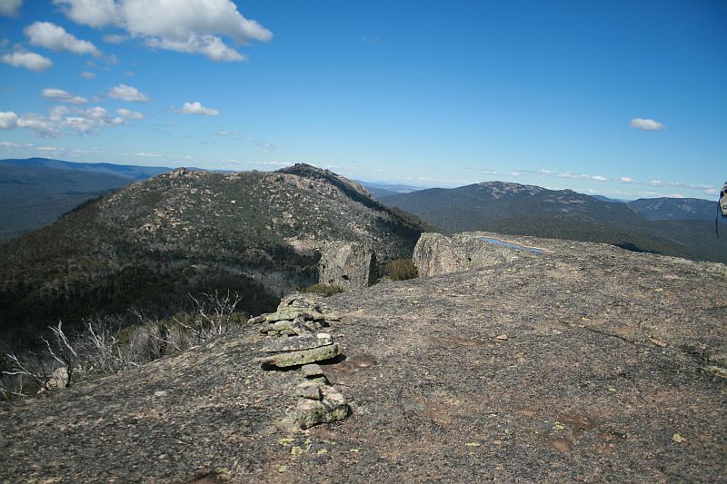
Border Markers along the Mt Gingera ridge - will the real Mt Gingera please stand up
Border markers in this area are covered in the
digitised original field book A 1022 - Q56 to P58 - FC18 sheet 12 ![]() - (PDF 12.7 mb). There are 8 markers on
the Gingera ridge. They are R57, S57, T57, U57, V57, 22 Mile, W57 and X57.
- (PDF 12.7 mb). There are 8 markers on
the Gingera ridge. They are R57, S57, T57, U57, V57, 22 Mile, W57 and X57.
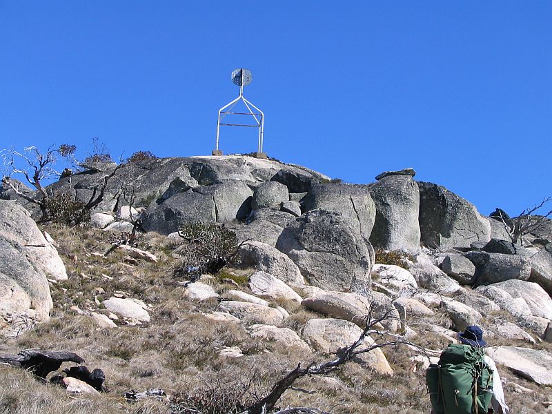
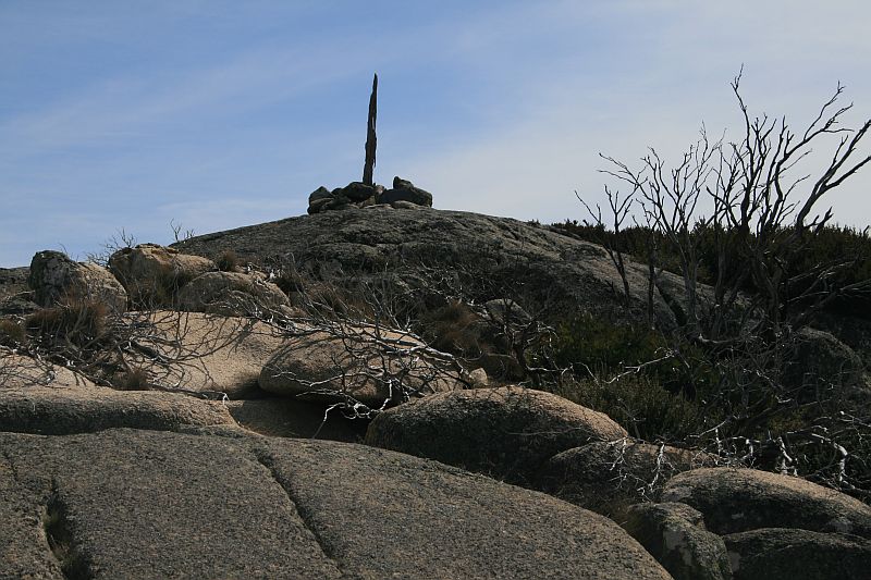
Alex P provided me with copies of 1:16000 map segments from Mt Coree to Mt Gingera, developed as a project guide for when the border was re-marked in this area. It shows the Mt Gingera (Mouat) trig point in the centre of the ridge around the top, with border marker W57 at the same location. At the SE end of the ridge, the map is annotated with a hand drawn trig marker and 'NATMAP', with border marker X57 at the same location. With 106m difference between these two locations, it must be easy to sort this out - and it was. My Mt Gingera trips, right from the first time I was taken there, was to the guyed pole. This has X57 at its base and is, perhaps, the NATMAP Mt Gingera. Obvious once pointed out that the granite tors 106m to the NW along the ridge are higher. Will continue to hunt for W57 (the real Mt Gingera), although if the 1" Gaspipe is driven flush into the cleft of the boulder, it will be hard to find if covered with leaf litter, etc:
Border Marker No Survey Notes No Comment from Survey Notes5 Heritage Register Site No/Sourced from Matthew Higgins' field work3 ACTPLA Location
UTM4 55H (MGA)Visited - click on a date for a walk report Click on a thumbnail below
to see the full sized PictureR57 200 1" Pipe 50 660666.630-6062541.193 30 Apr 11
5 Feb 11
14 Apr 09
21 Mar 09*S57 201 none 51 660682.707-6062494.256 14 Apr 09* T57 202 none 52 660725.623-6062377.865 14 Apr 09* U57 203 Station on Granite Boulder 1" Pipe cemented in crevisse [sic] of boulder about 12' above ground 53 660864.749-6062197.522 14 Apr 09* V57 203A 1" Pipe Rock Station 54 661030.003-6061901.631 14 Apr 09* 22 Mile 3" Downpipe with Concrete Core and Bolt - 178917.156-571311.027
(ACT grid2 from annotated 1:16000 map segment)
= 661106-6061788 (MGA)
661106.415-6061788.112
(calculated)30 Apr 11
14 Apr 09*W57 204 Mount Gingera (MOUAT) Trig Point - 1" Gaspipe driven into cleft of Boulder
Mike L told me in 4/11 that Phil A put a drill hole and wing there during a 2004 re-survey- 661255.85-6061566.164 not found
30 Apr 11
5 Feb 11
12 Jun 10
19 May 09,
14 Apr 09Does anyone have a metal detector? X57 205 1" Pipe and Cairn - 661318.641-6061480.184 30 Apr 11
12 Jun 10
19 May 09
14 Apr 09*
Border Markers from Mt Gingera to Blackfellows Gap
Border markers in this area are covered in the digitised original field books A 1022 - Q56 to P58 - FC18 sheet 12 ![]() - (PDF 12.7 mb) and A 1024 - P58 to R59 - FC18 sheet 12 - (PDF 11.5 MB). Another lovely area of
mountain grasses and Snow Gums, very different to the harsh Mt Franklin fire
trail down below to the E:
- (PDF 12.7 mb) and A 1024 - P58 to R59 - FC18 sheet 12 - (PDF 11.5 MB). Another lovely area of
mountain grasses and Snow Gums, very different to the harsh Mt Franklin fire
trail down below to the E:
Border Marker No Survey Notes No Comment from Survey Notes5 Heritage Register Site No/Sourced from Matthew Higgins' field work3 ACTPLA Location
UTM4 55H (MGA)Visited - click on a date for a walk report Click on a thumbnail below
to see the full sized PictureY57 206 Iron Spike in rock - 661342.951-6061414.897 19 May 09* Z57 207 Pipe 1"x15" on Boulder 55 661422.992-6061330.367 19 May 09* A58 208 Pipe and Cairn - 661478.169-6061257.226 19 May 09* B58 209 1" Galv Pipe and Cairn - 661480.698-6061139.657 19 May 09* C58 210 8" Post - 661511.131-6061032.948 19 May 09* D58 211 8" Post - 661634.541-6060989.605 19 May 09* E58 212 8" Post - 661728.819-6060947.549 19 May 09* F58 213 1" Galv Pipe and Cairn 56 661832.006-6060891.671 19 May 09* G58 214 1" Galv Pipe and Cairn on Rock Mass
Line drops 30' Vertical 10 links on from Station57 661872.553-6060762.430 19 May 09* H58 215 1" Galv Pipe and Cairn - 661913.269-6060659.347 19 May 09* I58 215A 1" Galv Pipe and Cairn 58 661926.866-6060598.937 19 May 09* 23 Mile Concreted downpipe and Cairn
Milepoint falls on side of boulder- 661976.257-6060485.997
(calculated)19 May 09* J58 216 1" Galv Pipe and Cairn - 661976.246-6060486.048 19 May 09* K58 217 1" Galv Pipe and Cairn - 662013.093-6060452.140 19 May 09* L58 218 1" Galv Pipe and Cairn - 662035.371-6060347.289 19 May 09* M58 219 1" Pipe and Cairn - 662048.481-6060294.913 19 May 09* N58 220 1" Galv Pipe and Cairn - 662060.223-6060236.641 19 May 09* O58 221 1" Galv Pipe and Cairn - 662016.534-6060149.776 11 May 10* P58 222 1" Galv Pipe and Cairn - 661939.587-6059986.170 11 May 10* Q58 223 8" Post - 661770.014-6059826.325 11 May 10* R58 224 8" Post - 661613.456-6059680.198 27 Oct 12
11 May 10*
R58 survey tree 131°33' 9.55 to Gum 661614.867-6059678.895
(calculated)27 Oct 12
11 May 10*
Border Markers between Blackfellows Gap and Rolling Ground Gap
Border markers in this area are covered in the digitised original field book A 1024 - P58 to R59 - FC18 sheet 12 - (PDF 11.5 MB):
Border Marker No Survey Notes No Comment from Survey Notes5 Heritage Register Site No/Sourced from Matthew Higgins' field work3 ACTPLA Location
UTM4 55H (MGA)Visited - click on a date for a walk report Click on a thumbnail below
to see the full sized PictureS58 225 1" Pipe and Cairn - 661540.257-6059461.959 not there
11 May 10located in middle of road T58 226 1" Pipe and Cairn - 661272.915-6059394.244 not there
11 May 1024 Mile - Concreted Downpipe sunk flush and Cairn - 661223.247-6059377.252
(calculated)visited location
but not identified
27 Oct 12
not searched for
11 May 10- U58 227 1" Pipe and Cairn - 661097.881-6059334.363 11 May 10* V58 228 1" Pipe and Cairn - 660941.215-6059258.178 11 May 10* W58 229 1" Pipe and Cairn - 660847.340-6059234.365 11 May 10* X58 230 1" Pipe and Cairn - 660749.256-6059188.538 11 May 10* Y58 231 1" Galv Pipe and Cairn - 660666.269-6059127.315 11 May 10* Z58 232 1" Galv Pipe and Cairn - 660636.376-6059025.515 11 May 10* A59 233 1" Galv Pipe and Cairn - 660564.566-6058931.882 11 May 10* B59 234 1" Pipe and Cairn - 660529.089-6058815.380 11 May 10* C59 235 1" Galv Pipe and Cairn - 660419.049-6058743.742 27 Oct 12* D59 236 1" Galv Pipe and Cairn - 660293.191-6058682.853 11 May 10* E59 237 1" Pipe and Cairn - 660243.930-6058670.290 11 May 10* F59 238 1" Pipe and Cairn Station on Boulder 59 660187.468-6058609.850 27 Oct 12
11 May 10*G59 239 1" Pipe and Cairn - 660227.391-6058503.042 visited location
but not identified
27 Oct 12- 25 Mile - Concreted Downpipe and Cairn - 660295.885-6058393.424
(calculated)27 Oct 12* H59 240 1" Pipe and Cairn - 660304.441-6058379.733 visited location
but not identified
27 Oct 12- I59 240 1" Galv Iron Pipe and Cairn 60 660379.400-6058270.286 27 Oct 12* J59 241 1" Galv Pipe and Cairn - 660413.539-6058179.055 27 Oct 12* J59 blaze - - 660418.310-6058183.798
(calculated)27 Oct 12*
remnant blazeK59 242 8" Post - 660466.883-6058067.148 27 Oct 12* L59 243 8" Post - 660558.595-6057922.276 visited location
but not identified
27 Oct 12- M59 244 8" Post - 660652.826-6057851.916 27 Oct 12* N59 245 8" Post - 660755.290-6057777.702 27 Oct 12* O59 246 8" Post - 660880.099-6057669.807 27 Oct 12*
Border Markers between Rolling Ground Gap and Leura Gap
Border markers in this area are covered in
the digitised original field book A 1024 - P58 to R59 - FC18 sheet 12 - (PDF 11.5 MB) and A 1055 - K59 to K76 - FC18 sheet 11, 12 ![]() - (PDF 12.5 mb). There are 19 border
markers in the area - P59, Q59 and R59 with no descriptions; 26 Mile with
description '3" Concreted Downpipe and Mound'; A73, B73, C73 with no
descriptions; D73, E73, F73, G73, H73 sketched on page 5b of the notebook with
description 'All stations marked with iron pipes 1"x15" filled with concrete,
sunk flush and surrounded by cairn'; I73, J73, K73, L73 sketched on page 6b of
the notebook with description 'All stations marked by iron pipes 1"x15" sunk
flush, filled with concrete and cairned.'; M73, N73, O73 with no description. In
the sketch on page 7b of the notebook, a marker with description 'Concreted
Downpipe and Cairn' is crossed through - yet it must correspond to site # 65 in
the ACT Heritage Register list for the 27 Mile marker. Found 1 by chance prior
to border marker mania setting in and plan to go back on 19 May 09:
- (PDF 12.5 mb). There are 19 border
markers in the area - P59, Q59 and R59 with no descriptions; 26 Mile with
description '3" Concreted Downpipe and Mound'; A73, B73, C73 with no
descriptions; D73, E73, F73, G73, H73 sketched on page 5b of the notebook with
description 'All stations marked with iron pipes 1"x15" filled with concrete,
sunk flush and surrounded by cairn'; I73, J73, K73, L73 sketched on page 6b of
the notebook with description 'All stations marked by iron pipes 1"x15" sunk
flush, filled with concrete and cairned.'; M73, N73, O73 with no description. In
the sketch on page 7b of the notebook, a marker with description 'Concreted
Downpipe and Cairn' is crossed through - yet it must correspond to site # 65 in
the ACT Heritage Register list for the 27 Mile marker. Found 1 by chance prior
to border marker mania setting in and plan to go back on 19 May 09:
Border Marker No Survey Notes No Comment from Survey Notes5 Heritage Register Site No/Sourced from Matthew Higgins' field work3 ACTPLA Location
UTM4 55H (MGA)Visited - click on a date for a walk report Click on a thumbnail below
to see the full sized PictureP59 247 8" Post - 661049.605-6057471.160 visited location
but not identified
27 Oct 12- Q59 248 8" Post - 661127.427-6057317.616 27 Oct 12* R59 249 Pipe and Cairn Open swampy flat - 661172.127-6057161.698 27 Oct 12* 26 Mile 3" Concreted Downpipe 2' long and Cairn - 661189.352-6057101.616
(calculated)27 Oct 12* A73 - 661241.681-6057002.365 Possible
identification
27 Oct 12*B73 - 661235.634-6056926.952 27 Oct 12* C73 - 661257.433-6056700.777 27 Oct 12* D73 - 661183.642-6056547.859 27 Oct 12* E73 61 661150.270-6056449.871 27 Oct 12* F73 - 661159.958-6056325.035 27 Oct 12* G73 All stations marked with iron pipes 1"x15" filled with concrete, sunk flush and surrounded by cairn - 661230.897-6056184.596 27 Oct 12
9-10 Jan 09*H73 All stations marked with iron pipes 1"x15" filled with concrete, sunk flush and surrounded by cairn 62 661252.887-6056073.625 27 Oct 12* I73 63 661403.072-6056047.899 27 Oct 12* J73 64 661467.251-6055914.760 27 Oct 12* K73 - 661496.412-6055789.492 27 Oct 12* 27 Mile 65 661467.860-6055697.040
(calculated)27 Oct 12* L73 - 661450.097-6055639.528 27 Oct 12* M73 - 661395.476 -6055597.673 27 Oct 12* N73 - 661334.563-6055535.352 27 Oct 12* O73
Border Markers between Rolling Ground Gap and Leura Gap
Border markers in this area are covered in
the digitised original field book A 1024 - P58 to R59 - FC18 sheet 12 - (PDF 11.5 MB) and A 1055 - K59 to K76 - FC18 sheet 11, 12 ![]() - (PDF 12.5 mb). There are 19 border
markers in the area - P59, Q59 and R59 with no descriptions; 26 Mile with
description '3" Concreted Downpipe and Mound'; A73, B73, C73 with no
descriptions; D73, E73, F73, G73, H73 sketched on page 5b of the notebook with
description 'All stations marked with iron pipes 1"x15" filled with concrete,
sunk flush and surrounded by cairn'; I73, J73, K73, L73 sketched on page 6b of
the notebook with description 'All stations marked by iron pipes 1"x15" sunk
flush, filled with concrete and cairned.'; M73, N73, O73 with no description. In
the sketch on page 7b of the notebook, a marker with description 'Concreted
Downpipe and Cairn' is crossed through - yet it must correspond to site # 65 in
the ACT Heritage Register list for the 27 Mile marker. Found 1 by chance prior
to border marker mania setting in and plan to go back on 19 May 09:
- (PDF 12.5 mb). There are 19 border
markers in the area - P59, Q59 and R59 with no descriptions; 26 Mile with
description '3" Concreted Downpipe and Mound'; A73, B73, C73 with no
descriptions; D73, E73, F73, G73, H73 sketched on page 5b of the notebook with
description 'All stations marked with iron pipes 1"x15" filled with concrete,
sunk flush and surrounded by cairn'; I73, J73, K73, L73 sketched on page 6b of
the notebook with description 'All stations marked by iron pipes 1"x15" sunk
flush, filled with concrete and cairned.'; M73, N73, O73 with no description. In
the sketch on page 7b of the notebook, a marker with description 'Concreted
Downpipe and Cairn' is crossed through - yet it must correspond to site # 65 in
the ACT Heritage Register list for the 27 Mile marker. Found 1 by chance prior
to border marker mania setting in and plan to go back on 19 May 09:
Border Marker No Survey Notes No Comment from Survey Notes5 Heritage Register Site No/Sourced from Matthew Higgins' field work3 ACTPLA Location
UTM4 55H (MGA)Visited - click on a date for a walk report Click on a thumbnail below
to see the full sized PictureP59 247 8" Post - 661049.605-6057471.160 visited location
but not identified
27 Oct 12- Q59 248 8" Post - 661127.427-6057317.616 27 Oct 12* R59 249 Pipe and Cairn Open swampy flat - 661172.127-6057161.698 27 Oct 12* 26 Mile 3" Concreted Downpipe 2' long and Cairn - 661189.352-6057101.616
(calculated)27 Oct 12* A73 - 661241.681-6057002.365 Possible
identification
27 Oct 12*B73 - 661235.634-6056926.952 27 Oct 12* C73 - 661257.433-6056700.777 27 Oct 12* D73 - 661183.642-6056547.859 27 Oct 12* E73 61 661150.270-6056449.871 27 Oct 12* F73 - 661159.958-6056325.035 27 Oct 12* G73 All stations marked with iron pipes 1"x15" filled with concrete, sunk flush and surrounded by cairn - 661230.897-6056184.596 27 Oct 12
9-10 Jan 09*H73 All stations marked with iron pipes 1"x15" filled with concrete, sunk flush and surrounded by cairn 62 661252.887-6056073.625 27 Oct 12* I73 63 661403.072-6056047.899 27 Oct 12* J73 64 661467.251-6055914.760 27 Oct 12* K73 - 661496.412-6055789.492 27 Oct 12* 27 Mile 65 661467.860-6055697.040
(calculated)27 Oct 12* L73 - 661450.097-6055639.528 27 Oct 12* M73 - 661395.476 -6055597.673 27 Oct 12* N73 - 661334.563-6055535.352 27 Oct 12* O73 - 661209.992-6055296.259 5-6 Apr 13*
Border Markers from Leura Gap to Bimberi Gap
Border markers in this area are covered in
the digitised original field book A 1055 - K59 to K76 - FC18 sheet 11, 12 ![]() - (PDF 12.5 mb).
- (PDF 12.5 mb).
Border Marker No Survey Notes No Comment from Survey Notes5 Heritage Register Site No/Sourced from Matthew Higgins' field work3 ACTPLA Location
UTM4 55H (MGA)Visited - click on a date for a walk report Click on a thumbnail below
to see the full sized PictureP73 - - 66 660827.217-6054920.131 5-6 Apr 13* Q73 - - 67 660776.133-6054908.103 5-6 Apr 13* 28 Mile - Concreted Downpipe and Cairn, mile point falls on side of boulder - 660364.999-6054558.523
(calculated)5-6 Apr 13* R73 - - - 660333.660-6054531.888 5-6 Apr 13* S73 - - - 660365.999-6054461.708 visited location
but not identified
5-6 Apr 13- T73 - - 68 660430.952-6054396.804 5-6 Apr 13* U73 - - 69 660406.019-6054270.520 5-6 Apr 13* V73 - - - 660377.680-6054162.615 visited location
but not identified
5-6 Apr 13- W73 - - - 660404.464-6053995.103 5-6 Apr 13* X73 - - 70 660367.607-6053885.018 5-6 Apr 13* Y73 - - 71 660282.733-6053841.706 5-6 Apr 13* Z73 - - - 660165.021-6053886.977 5-6 Apr 13* A74 - - 72 660071.182-6053775.067 5-6 Apr 13* B74 - - - 660014.777-6053718.850 5-6 Apr 13* C74 - - - 660055.713-6053655.987 5-6 Apr 13* D74 - - 73 660097.880-6053582.792 5-6 Apr 13* E74 - - 74 660197.476-6053480.119 5-6 Apr 13* F74 - - 75 660253.345-6053441.466 5-6 Apr 13* 29 Mile - Concreted Downpipe and Cairn 76 660304.395-6053445.887
(calculated)5-6 Apr 13* G74 - Station on granite boulder 77 660396.077-6053453.824 5-6 Apr 13* H74 - - - 660492.018-6053417.995 5-6 Apr 13* I74 - - - 660502.245-6053337.276 5-6 Apr 13* J74 - - - 660510.078-6053204.012 5-6 Apr 13* K74 - - - 660428.290-6053014.793 5-6 Apr 13* L74 - - - 660454.944-6052951.145 5-6 Apr 13* M74 - - - 660504.771-6052857.638 5-6 Apr 13* N74 - 4" Nail in Concrete in bare rock 78 660542.175-6052811.793 5-6 Apr 13* O74 - 1" Pipe and Cairn - 660647.418-6052796.025 5-6 Apr 13* O74 blaze - - - 660645.036-6052795.128
(calculated)5-6 Apr 13* P74 - 1" Pipe and Cairn - 660706.410-6052773.868 visited location
but not identified
5-6 Apr 13- Q74 - 1" Pipe and Cairn - 660802.004-6052774.199 visited location
but not identified
5-6 Apr 13- R74 - 1" Pipe and Cairn - 660913.724-6052768.374 visited location
but not identified
5-6 Apr 13- S74 - 1" Pipe and Cairn - 660973.745-6052754.673 5-6 Apr 13* T74 - 1" Pipe and Cairn - 661122.415-6052748.543 5-6 Apr 13* U74 - - - 661216.418-6052746.558 5-6 Apr 13* V74 - - - 661285.684-6052763.272 visited location
but not identified
5-6 Apr 13- 30 Mile - Concreted Downpipe and Cairn - 661289.879-6052761.567
(calculated)visited location
but not identified
5-6 Apr 13- W74 - - - 661370.529-6052728.777 5-6 Apr 13* X74 - - - 661431.456-6052708.065 5-6 Apr 13* Y74 - - 79 661510.104-6052644.954 5-6 Apr 13* Z74 - - 80 661600.705-6052613.196 5-6 Apr 13* A75 - - 81 661677.897-6052581.382 5-6 Apr 13* B75 - - 82 661709.365-6052526.389 5-6 Apr 13* C75 - Spike and Cairn 83 661698.961-6052455.743 5-6 Apr 13* D75 - 1" Pipe and Cairn 84 661754.079-6052241.882 5-6 Apr 13* E75 - 1" Pipe and Cairn 85 661807.480-6052224.291 5-6 Apr 13* F75 - Spike and Cairn - 662007.742-6052313.155 5-6 Apr 13*
Border Markers from Bimberi Peak through Murrays Gap to Mt Murray
Border markers in this area are covered in
the digitised original field books A 1055 - K59 to K76 - FC18 sheet 11, 12 ![]() - (PDF 12.5 mb) and A 1056 - K76 to W79 - FC 18 sheet 11
- (PDF 12.5 mb) and A 1056 - K76 to W79 - FC 18 sheet 11 ![]() - (PDF 12.6 mb):
- (PDF 12.6 mb):
Border Marker No Survey Notes No Comment from Survey Notes5 Heritage Register Site No/Sourced from Matthew Higgins' field work3 ACTPLA Location
UTM4 55H (MGA)Visited - click on a date for a walk report Click on a thumbnail below
to see the full sized PictureBimberi Trig Station - - - 662078.213-6052360.256 12-14 Sep 06*
5-6 Apr 13G75 - 1" Pipe and Cairn - 662178.150-6052272.278 5-6 Apr 13* H75 - 1" Pipe and Cairn 86 662262.293-6052164.065 5-6 Apr 13* I75 - 1" Pipe and Cairn 87 662368.086-6052046.999 5-6 Apr 13* 31 Mile - Concreted Downpipe sunk 4" below surface 88 662384.058-6052017.742
(calculated)5-6 Apr 13* J75 - 1" Pipe and Cairn - 662411.609-6051967.260 5-6 Apr 13* K75 - 1" Pipe and Cairn 89 662457.194-6051889.648 5-6 Apr 13* L75 - 1" Pipe and Cairn 90 662599.422-6051804.848 5-6 Apr 13* M75 - 1" Pipe and Cairn - 662590.391-6051739.197 5-6 Apr 13* N75 - 1" Pipe and Cairn - 662626.052-6051689.766 5-6 Apr 13* O75 - 1" Pipe and Cairn 91 662682.479-6051615.677 5-6 Apr 13* P75 - 1" Pipe and Cairn 92 662778.038-6051540.111 5-6 Apr 13* Q75 - 1" Pipe and Cairn 93 662783.824-6051497.489 5-6 Apr 13* R75 - 1" Pipe and Cairn 94 662730.553-6051389.650 5-6 Apr 13* S75 - 1" Pipe and Cairn - 662690.685-6051299.873 5-6 Apr 13* T75 - 1" Pipe and Cairn - 662680.951-6051166.037 5-6 Apr 13* U75 - 1" Pipe and Cairn - 662668.731-6051059.607 5-6 Apr 13* V75 - 1" Pipe and Cairn - 662652.045-6050977.966 5-6 Apr 13* W75 - 1" Pipe and Cairn - 662661.620-6050892.404 5-6 Apr 13* X75 - 1" Pipe and Cairn - 662696.517-6050803.342 visited location
but not identified
5-6 Apr 13- Y75 - 1" Pipe and Cairn - 662723.147-6050705.757 5-6 Apr 13* 32 Mile - Concreted Downpipe sunk flush and Cairn - 662725.551-6050621.368
(calculated)visited location
but not identified
5-6 Apr 13- Z75 - 1" Pipe and Cairn - 662727.172-6050564.273 5-6 Apr 13* A76 - 1" Pipe and Cairn - 662753.229-6050480.672 5-6 Apr 13* B76 - 1" Pipe and Cairn - 662738.174-6050374.633 5-6 Apr 13* C76 - 1" Pipe and Cairn - 662728.949-6050317.474 5-6 Apr 13* D76 - 1" Pipe and Cairn - 662711.325-6050232.929 5-6 Apr 13* E76 - - - 662669.292-6050144.857 5-6 Apr 13* F76 - - - 662680.988-6050091.949 5-6 Apr 13* G76 - - - 662664.295-6050007.531 4 Feb 12*
5-6 Apr 13H76 - 1" Pipe - 662629.628-6049894.720 not found
1-4 Oct 10
visited location
but not identified
5-6 Apr 13
- I76 - 1" Pipe - 662575.437-6049761.622 not found
1-4 Oct 10
visited location
but not identified
5-6 Apr 13- J76 - 1" Pipe Concreted - 662493.221-6049658.673 possible find
1-4 Oct 10*
visited location
but not identified
5-6 Apr 13K76 - 1" Pipe and Cairn - 662473.418-6049599.387 5-6 Apr 13* L76 - 1" Pipe and Cairn - 662389.627-6049492.972 5-6 Apr 13* M76 - 1" Pipe and Cairn - 662346.778-6049427.007 visited location
but not identified
5-6 Apr 13- N76 - 1" Pipe and Cairn - 662308.151-6049379.817 visited location
but not identified
5-6 Apr 13- O76 - - - 662266.439-6049308.733 5-6 Apr 13* P76 - - - 662245.005-6049237.001 5-6 Apr 13* Q76 - - - 662233.677-6049171.380 5-6 Apr 13* 33 Mile - Short downpipe with concrete core buried 3" - 662227.412-6049152.463
(calculated)5-6 Apr 13* R76 - - - 662204.974-6049084.724 5-6 Apr 13* S76 - - 95 662181.845-6049028.815 5-6 Apr 13*
Border Markers from Mt Murray to Yaouk Gap
This is a grand Snow Gum and mountain grasses
area. The border markers are covered in the digitised original field book A 1056 - K76 to W79 - FC 18 sheet 11 ![]() - (PDF 12.6 mb).
- (PDF 12.6 mb).
Border Marker No Survey Notes No Comment from Survey Notes5 Heritage Register Site No/Sourced from Matthew Higgins' field work3 ACTPLA Location
UTM4 55H (MGA)Visited - click on a date for a walk report Click on a thumbnail below
to see the full sized PictureT76 - Mt Murray Summit 96 662091.197-6048994.956 7 Apr 09*
5-6 Apr 13U76 - 1" Pipe and Cairn - 662085.740-6048941.595 7 Apr 09*
5-6 Apr 13V76 - 1" Pipe and Cairn 97 662069.954-6048863.258 5-6 Apr 13* V76 blaze - - - 662069.435-6048859.025
(calculated)5-6 Apr 13* W76 - 1" Pipe and Cairn 98 662085.152-6048813.843 5-6 Apr 13* X76 - 1" Pipe and Cairn - 662100.587-6048762.359 5-6 Apr 13* Y76 - - - 662067.296-6048710.923 5-6 Apr 13* Z76 - - - 662064.718-6048651.655 5-6 Apr 13* A77 - - - 662085.718-6048587.267 5-6 Apr 13* B77 - 1" Pipe and Cairn - 661995.842-6048433.961 5-6 Apr 13* C77 - 1" Pipe and Cairn - 661968.063-6048373.154 5-6 Apr 13* D77 - 1" Pipe and Cairn - 661920.428-6048307.884 5-6 Apr 13* E77 - 1" Pipe and Cairn - 661894.920-6048238.675 5-6 Apr 13* F77 - 1" Pipe and Cairn - 661836.485-6048163.394 visited location
but not identified
5-6 Apr 13- G77 - - - 661809.250-6048094.508 5-6 Apr 13* H77 - - - 661848.216-6047986.875 5-6 Apr 13* I77 - - - 661880.982-6047893.512 5-6 Apr 13* J77 - 1" Pipe and Cairn - 661912.880-6047819.677 5-6 Apr 13* 34 Mile - Concreted Downpie and Cairn Mile Point comes on side of boulder - 661951.875-6047740.013
(calculated)5-6 Apr 13* K77 - 1" Pipe and Cairn - 661954.604-6047734.425 5-6 Apr 13* L77 - 1" Pipe and Cairn - 661970.987-6047662.704 5-6 Apr 13* M77 - - - 661997.362-6047586.243 5-6 Apr 13* N77 - 1" Pipe and Cairn - 662040.459-6047528.107 5-6 Apr 13* O77 - 1" Pipe and Cairn - 662038.167-6047466.928 5-6 Apr 13* P77 - 1" Pipe and Cairn - 662071.894-6047427.127 5-6 Apr 13* Q77 - 1" Pipe and Cairn - 662127.380-6047385.991 7 Apr 09*
5-6 Apr 13R77 - 1" Pipe and Cairn - 662189.673-6047334.974 visited location
but not identified
5-6 Apr 13- S77 - 1" Pipe and Cairn - 662235.328-6047273.788 5-6 Apr 13* T77 - 1" Pipe and Cairn - 662224.241-6047206.747 5-6 Apr 13* U77 - 1" Pipe and Cairn Station in granite rock - 662274.533-6047155.455 5-6 Apr 13* V77 - 1" Pipe and Cairn - 662319.024-6047126.299 5-6 Apr 13* W77 - 1" Pipe and Cairn - 662416.866-6047017.257 5-6 Apr 13* X77 - 1" Pipe and Cairn - 662486.929-6046957.197 5-6 Apr 13* Y77 - 1" Pipe and Cairn - 662518.855-6046860.522 5-6 Apr 13* Z77 - 1" Pipe and Cairn - 662495.239-6046800.926 5-6 Apr 13* A78 - - - 662555.872-6046765.931 5-6 Apr 13* B78 - - - 662653.499-6046694.934 5-6 Apr 13* C78 - - - 662737.185-6046672.446 5-6 Apr 13* D78 - - - 662779.855-6046619.813 5-6 Apr 13* E78 - - 99 662839.842-6046563.206 5-6 Apr 13* 35 Mile - Concreted Downpipe and Cairn - cannot calculate GR as no links in notebook visited location
but not identified
5-6 Apr 13- F78 - - 100 662909.157-6046529.705 5-6 Apr 13* F78 blaze - - - 662909.501-6046531.431
(calculated)5-6 Apr 13* G78 - - 101 662988.334-6046487.101 5-6 Apr 13* H78 - - - 663042.742-6046427.200 5-6 Apr 13* I78 - - - 663107.620-6046349.134 5-6 Apr 13* J78 - - 102 663197.226-6046270.179 5-6 Apr 13* K78 - - 103 663299.204-6046269.072 5-6 Apr 13* L78 - - - 663400.277-6046169.595 visited location
but not identified
5-6 Apr 13- M78 - - - 663480.668-6046094.678 visited location
but not identified
5-6 Apr 13- N78 - - - 663527.843-6046021.367 5-6 Apr 13* N78 blaze - - - 663529.488-6046017.663
(calculated)5-6 Apr 13* O78 - - - 663589.775-6045908.331 visited location
but not identified
5-6 Apr 13- P78 - - - 663753.322-6045813.264 visited location
but not identified
5-6 Apr 13- Q78 - - - 663854.636-6045789.027 5-6 Apr 13* R78 - - - 663890.678-6045697.755 5-6 Apr 13* S78 - - 104 663966.022-6045619.760 5-6 Apr 13* T78 - - - 664014.113-6045605.993 5-6 Apr 13* 36 Mile - Concreted Downpipe 2' long with earth mound - 664047.340-6045605.378
(calculated)5-6 Apr 13* U78 - - - 664094.690-6045604.496 5-6 Apr 13* V78 - - - 664259.916-6045644.460 visited location
but not identified
5-6 Apr 13- W78 - - - 664374.849-6045696.036 visited location
but not identified
5-6 Apr 13- X78 - - - 664508.554-6045724.609 visited location
but not identified
5-6 Apr 13- Y78 - - 664681.944-6045632.939 visited location
but not identified
22 Mar 14
5-6 Apr 13-
Border Markers in the Mt Scabby area
The Cotter River rises here and it would have to
be one of the most beautiful areas in the Namadgi National Park. If the area is
defined to be that above the 1700m contour, it contains 15 border markers and
each one should be identifiable as there are no wooden posts. They are covered
in the digitised original field book A 1057 - W79 to L82 - FC sheet 10, 11 ![]() - (PDF 12.4 mb). The border markers
are - G80, H80 with descriptions 'Concrete cylinder and cairn'; unidentified
marker (Mile marker?) with description 'Concreted cylinder covered with heavy
cairn'; I80 with description 'Concrete cylinder on bare granite and Cairn'; J80
'Concrete cylinder'; K80 'Concrete mark/cylinder and cairn'; L80, M80, N80, O80
and P80 with descriptions 'Nail in concrete'; unidentified marker (41 Mile from
ACT Heritage Register) with description 'Concrete cylinder on bare granite
heavily cairned'; Q80, R80 and S80 with descriptions 'Concrete cylinder and
cairn'. The following 5 found by good fortune prior to being given access to the
ACTPLA data:
- (PDF 12.4 mb). The border markers
are - G80, H80 with descriptions 'Concrete cylinder and cairn'; unidentified
marker (Mile marker?) with description 'Concreted cylinder covered with heavy
cairn'; I80 with description 'Concrete cylinder on bare granite and Cairn'; J80
'Concrete cylinder'; K80 'Concrete mark/cylinder and cairn'; L80, M80, N80, O80
and P80 with descriptions 'Nail in concrete'; unidentified marker (41 Mile from
ACT Heritage Register) with description 'Concrete cylinder on bare granite
heavily cairned'; Q80, R80 and S80 with descriptions 'Concrete cylinder and
cairn'. The following 5 found by good fortune prior to being given access to the
ACTPLA data:
Border Marker No Survey Notes No Comment from Survey Notes5 Heritage Register Site No/Sourced from Matthew Higgins' field work3 ACTPLA Location
UTM4 55H (MGA)Visited - click on a date for a walk report Click on a thumbnail below
to see the full sized PictureZ78 105 664842.751-6045468.365 22 Mar 14* A79 106 664856.830-6045380.705 22 Mar 14* B79 107 664894.488-6045286.708 22 Mar 14* C79 108 664896.886 6045215.843 22 Mar 14* D79 - 664933.814-6045106.860 visited location
but not identified
22 Mar 14- E79 - 665059.372-6045012.100 visited location
but not identified
22 Mar 14- F79 109 665140.314-6044985.295 22 Mar 14* 37 Mile Concreted Downpipe 2' long sunk flush with rock cairn 110 665213.058-6044943.265
(calculated)22 Mar 14* G79 - 665317.620-6044882.835 22 Mar 14* H79 111 665416.588-6044710.562 22 Mar 14* I79 112 665434.560-6044634.043 22 Mar 14* J79 - 665460.516-6044436.492 22 Mar 14* K79 - 665512.653-6044212.742 22 Mar 14* L79 - 665629.232-6044002.036 22 Mar 14* M79 Spike cemented in cleft of granite rock 113 665754.880-6043894.098 22 Mar 14* N79 Pipe 1"x15" 114 665772.541-6043731.193 22 Mar 14* 38 Mile Concreted 2' long Downpipe heavily cairned Milepoint on side of boulder 115 665854.562-6043531.630
(calculated)22 Mar 14* O79 Pipe 1"x15" 116 665857.155-6043525.282 22 Mar 14* P79 Pipe 1"x15" - 665908.105-6043277.520 22 Mar 14* Q79 Pipe 1"x15" - 665959.747-6043209.431 22 Mar 14* R79 Pipe 1"x15" - 666002.076-6043121.783 22 Mar 14* S79 Pipe 1"x15" 117 666124.326-6042982.945 22 Mar 14* T79 Pipe 1"x15" - 666253.988-6042860.239 22 Mar 14* U79 Cement cylinder on boulder 118 666350.330-6042715.505 22 Mar 14* 
V79 Pipe 1"x15" - 666459.274-6042594.863 visited location
but not identified
22 Mar 14- W79 Pipe 1"x15" and Cairn - 666634.531-6042471.579 visited location
but not identified
22 Mar 14- X79 Pipe 1"x15" and Cairn - 666704.160-6042402.935 22 Mar 14* Y79 1" Pipe and Cairn - 666792.753-6042311.731 22 Mar 14* 39 Mile 2" Concreted Downpipe sunk flush with earth mound - 666813.829-6042302.813 visited location
but not identified
22 Mar 14- Z79 1" Pipe and Cairn - 666913.709-6042260.540 22 Mar 14* A80 Pipe 1"x15" and Cairn - 667004.905-6042148.166 22 Mar 14* B80 Pipe 1"x15" and Cairn - 667120.169-6042101.029 22 Mar 14* C80 Concrete mark on boulder - 667166.233-6042083.986 22 Mar 14* 
D80 Pipe 1"x15" and Cairn - 667230.285-6042098.339 22 Mar 14* E80 Pipe 1"x15" and Cairn - 667358.828-6042055.772 22 Mar 14* 
F80 8" Spike and Cairn - 667577.096-6042079.099 possible
identification
22 Mar 14*G80 Concrete cylinder and cairn 119 667633.090-6042061.210 22 Mar 14* H80 Concrete cylinder and cairn - 667812.762-6041798.041 visited location
but not identified
22 Mar 14- 40 Mile Concreted cylinder covered with heavy cairn 120 667743.575-6041420.195
(calculated)22 Mar 14* I80 Concrete cylinder on bare granite and Cairn 121 667696.772-6041164.843 22 Mar 14
13-14 Jul 13
15 Apr 08*J80 Concrete cylinder; Cement mark on rock 122 667759.404-6040976.348 13-14 Jul 13* K80 Concrete mark/cylinder and cairn; Cement mark on rock - 667926.330-6040917.750 13-14 Jul 13* L80 Nail in concrete; Cement mark on rock 123 667979.372-6040941.619 13-14 Jul 13* M80 Nail in concrete; Cement mark on rock 124 668120.929-6041003.801 13-14 Jul 13
8-9 Jul 06*N80 Nail in concrete; Cement mark on rock 125 668208.424-6041100.749 13-14 Jul 13
15 Apr 08*O80 Nail in concrete; Cement mark on rock 126 668274.419-6041178.754 13-14 Jul 13
15 Apr 08*P80 127 668379.275-6041345.621 13-14 Jul 13* 41 Mile 128 668280.345-6041661.506
(calculated)13-14 Jul 13* Q80 Concrete cylinder and Cairn 129 668263.170-6041716.475 13-14 Jul 13
15 Apr 08*R80 - 668234.392-6041867.162 13-14 Jul 13* S80 - 668302.393-6042161.776 13-14 Jul 13* T80 - 668420.275-6042242.642 13-14 Jul 13* U80 - 668534.197-6042400.390 13-14 Jul 13* V80 130 668545.315-6042450.988 13-14 Jul 13* W80 131 668550.890-6042518.726 13-14 Jul 13* X80 - 668633.997-6042896.628 visited location
but not identified
13-14 Jul 13- Y80 - 668631.039-6043021.666 13-14 Jul 13* 42 Mile+1ch - 668730.066-6043129.212
(calculated)visited location
but not identified
13-14 Jul 13- Z80 Pipe 1"x15" and cairn - 668805.970-6043211.620 14-16 Mar 14
13-14 Jul 13*A81 8" Spike in Concrete 132 668871.528-6043426.576 14-16 Mar 14*
B81 Concrete cylinder and cairn 133 668811.995-6043600.966 14-16 Mar 14* C81 Concrete cylinder and Cairn 134 668575.556-6043966.491 14-16 Mar 14* D81 Concrete cylinder and Cairn 135 668739.765-6044215.430 14-16 Mar 14* E81 Pipe 1"x15" and Cairn 136 668866.820-6044180.143 14-16 Mar 14* F81 Spike in concrete 137 668947.482-6044236.053 14-16 Mar 14* G81 Concrete cylinder and Cairn 138 668992.898-6044271.950 14-16 Mar 14* 43 Mile 3" Concreted Downpipe Sunk flush and heavily cairned 668995.951-6044315.609
(calculated)14-16 Mar 14* H81 Pipe 1"x15" and Cairn 139 669001.750-6044398.446 14-16 Mar 14* I81 Pipe 1"x15" and Cairn 140 669073.204-6044488.047 14-16 Mar 14* J81 Pipe 141 669166.516-6044647.475 14-16 Mar 14* K81 Nail in concrete and cairn 142 669216.086-6044741.431 14-16 Mar 14* L81 Pipe 1"x15" and cairn 669274.577-6044874.643 14-16 Mar 14* M81 Pipe 1"x15" and Cairn 669315.992-6045019.306 14-16 Mar 14* N81 Pipe 1"x15" and cairn 669339.030-6045134.912 visited location
but not identified
14-16 Mar 14- O81 Pipe 143 669352.618-6045213.862 14-16 Mar 14* P81 Nail in concrete and cairn 144 669363.935-6045332.479 14-16 Mar 14* Q81 Nail in concrete and cairn 145 669510.359-6045466.881 14-16 Mar 14*
Border Markers between Mt Kelly and Sentry Box Mountain
The ones I have found are covered in the digitised original field books A 1057 - W79 to L82 - FC sheet 10, 11 ![]() -
(PDF 12.4 mb) and A 1058 - L82 to R85 - FC18 sheet 10
-
(PDF 12.4 mb) and A 1058 - L82 to R85 - FC18 sheet 10 ![]() - (PDF 12.4 mb). Data from the 1944 re-survey maps also covers this area:
- (PDF 12.4 mb). Data from the 1944 re-survey maps also covers this area:
Border Marker No Survey Notes No Comment from Survey Notes5 Heritage Register Site No/Sourced from Matthew Higgins' field work3 ACTPLA Location
UTM4 55H (MGA)Visited - click on a date for a walk report Click on a thumbnail below
to see the full sized PictureR81 Concrete cylinder heavily cairned Named by me "Mt Kelly" 146 669850.608-6046040.743 14-16 Mar 14
13-14 Jul 13
7-8 Jul 12
19 Sep 09*
15 Dec 07
21-22 Jul 07
9-11 Dec 06
8-9 Jul 06
22-24 Apr 06
2-3 Jan 06S81 Cement mark 147 669893.625-6045991.961 14-16 Mar 14*
7-8 Jul 12
19 Sep 09*T81 Pipe 1" x 15" and cairn 148 670041.423-6045951.185 14-16 Mar 14*
7-8 Jul 12
V81 Pipe 1" x 15" and cairn - 670395.181-6045778.350 14-16 Mar 14
7-8 Jul 12*W81 Pipe 1" x 15" and cairn 149 670504.607-6045698.309 14-16 Mar 14* X81 Concrete cylinder and cairn
(but it's a 1" gal pipe)150 670654.889-6045550.649 14-16 Mar 14* Y81 Concrete cylinder and cairn 151 670703.053-6045398.608 14-16 Mar 14* Z81 Concrete cylinder and cairn 152 670783.715-6045251.730 14-16 Mar 14* A82 Concrete cylinder and cairn 153 670888.139-6045152.349 14-16 Mar 14* B82 Concrete cylinder and cairn 154 670995.189-6044926.526 14-16 Mar 14* C82 Pipe 1" x 15" and cairn - 671141.869-6044522.289 14-16 Mar 14* D82 Concrete cylinder and cairn - 671152.636-6044295.058 14-16 Mar 14* E82 Pipe 1" x 15" and cairn - 670775.072-6043944.012 visited location
but not identified
14-16 Mar 14- 46 Mile 1" Concreted pipe and earth mound - 670774.036-6043937.101
(calculated)visited location
but not identified
14-16 Mar 14- Q82 Concrete cylinder 164 671682.123-6041972.558 5 Apr 08* R82 Concrete cylinder 165 671715.571-6041903.680 5 Apr 08* S82 Spike in concrete - 671889.281-6041547.328 not seen
28 Sep 10T82 Cement cylinder - 671906.934-6041536.995 not seen
28 Sep 10U82 15" Pipe - 672003.621-6041435.035 28 Sep 10* 
V82 15" Pipe - 672039.423-6041381.401 not seen
28 Sep 1048 Mile 3" Concreted Downpipe (bolt) and Cairn - 672040.623-6041377.279
(calculated)not seen
28 Sep 10W82 Cement cylinder - 672066.249-6041289.256 28 Sep 10*
X82 Concrete cylinder - 672074.552-6041228.840 28 Sep 10* 
Y82 15" Pipe and Cairn - 672049.772-6041159.210 28 Sep 10* Z82 15" Pipe and Cairn - 672020.351-6041063.091 28 Sep 10* A83 15" Pipe and Cairn - 671974.818-6040959.628 28 Sep 10* B83 Spike in cleft of rock - 671929.563-6040809.004 28 Sep 10* 
C83 15" Pipe and Cairn - 671958.352-6040705.986 28 Sep 10* 
D83 - 671970.754-6040636.625 28 Sep 10* E83 Pipe and Cairn - 671924.305-6040579.830 28 Sep 10* 
F83 Pipe and Cairn - 671798.724-6040386.104 28 Sep 10* G83 Pipe and Cairn - 671766.092-6040283.774 28 Sep 10* H83 Pipe and Cairn 166 671693.167-6040154.616 28 Sep 10* 
I83 167 671606.405-6040097.584 28 Sep 10* I83 blaze
(calculated)28 Sep 10* J83 168 671485.348-6040017.875 28 Sep 10
12-13 Jul 10*49M 3" Concreted Downpipe (bolt) and Cairn 169 671468.959-6039998.592
(calculated)28 Sep 10* K83 Pipe 170 671391.482-6039907.453 28 Sep 10*
12-13 Jul 10*
L83 Pipe 171 671303.087-6039817.601 28 Sep 10
12-13 Jul 10*M83 Pipe 172 671280.004-6039697.203 28 Sep 10* 
N83 Pipe 173 671272.175-6039542.713 28 Sep 10
12-13 Jul 10*O83 174 671308.509-6039316.186 12-13 Jul 10* P83 175 671286.154-6039126.048 12-13 Jul 10* Q83 Pipe 176 671252.859-6039054.951 12-13 Jul 10*
R83
(ACTPLA label this Rb83)179 671321.556-6038874.730 14 Sep 10
12-13 Jul 10*Ra83 - 671259.413-6038737.819 14 Sep 10* Rb83
(ACTPLA
label this R83)- 671309.854-6038596.970 14 Sep 10* 50 Mile 3" Concreted Downpipe (bolt) and Cairn 180 671292.219-6038504.911
(calculated)14 Sep 10* S83 Cement cylinder on boulder 181 671282.801-6038455.815 14 Sep 10* 
T83 Pipe 182 671264.456-6038278.800 14 Sep 10* U83 Spike 183 671292.382-6038183.046 14 Sep 10* V83 Pipe 184 671300.127-6038050.727 14 Sep 10* W83 Pipe - 671361.430-6037857.570 14 Sep 10* X83 Pipe - 671375.618-6037714.291 14 Sep 10* Y83 Pipe 185 671376.472-6037652.984 14 Sep 10* Z83 Pipe - 671391.715-6037503.302 14 Sep 10* A84 Pipe 186 671426.165-6037337.545 14 Sep 10* B84 Concrete Cylinder 187 671431.402-6037293.344 14 Sep 10* 
C84 Pipe 188 671494.495-6037165.002 14 Sep 10* D84 Cement Cylinder 189 671438.456-6037056.270 14 Sep 10* D84 survey blaze - possible - 14 Sep 10* 51 Mile 3" Concreted Downpipe (bolt) 190 14 Sep 10* E84 Pipe 191 671361.070-6036939.908 14 Sep 10* E84 survey blaze - 14 Sep 10* F84 Pipe 192 671315.053-6036884.411 14 Sep 10* G84 Concrete Cylinder - 671254.455-6036807.287 14 Sep 10* 
H84 Pipe 193 671194.422-6036741.079 14 Sep 10* I84 Pipe - 671066.654-6036656.029 not seen
14 Sep 10J84 Pipe 194 671070.323-6036541.564 14 Sep 10*
K84 Concrete Cylinder -
station on boulder195 671044.130-6036413.069 14 Sep 10*
L84 196 670954.668-6036299.218 not seen
14 Sep 10M84 - Concreted Pipe and Cairn 197 670841.252-6036187.038 30 Aug 11* N84 - Concreted Pipe 1"X15" and Cairn 198 670793.280-6036083.457 30 Aug 11* O84 - Pipe 199 670750.422-6035907.450 30 Aug 11* P84 - Concrete cylinder - Station on boulder 200 670712.996-6035786.870 30 Aug 11* 
Q84 - Pipe 201 670687.205-6035741.607 30 Aug 11* 52 Mile - 1" Pipe and Cairn 202 670576.480-6035650.253
(calculated)30 Aug 11* R84 - Pipe 203 670529.322-6035611.372 30 Aug 11* R84 blaze - C'wealth broad arrow CT - 670529.909-6035619.034
(calculated)30 Aug 11*
possible identificationS84 - Pipe 204 670483.970-6035538.390 30 Aug 11* T84 - Pipe 205 670458.557-6035475.568 30 Aug 11* U84 - Pipe 206 670523.409-6035392.582 30 Aug 11* V84 - Pipe 207 670552.964-6035345.752 30 Aug 11* W84 - Pipe 208 670669.513-6035249.274 30 Aug 11* W84 blaze - C'wealth broad arrow CT - 670673.949-6035246.615
(calculated)30 Aug 11* X84 - Pipe 209 670850.780-6035047.715 30 Aug 11* Y84 - Pipe on face 210 670918.510-6034924.667 30 Aug 11* Z84 - 5" Nail in concrete buried 3" - 670939.818-6034792.641 12 May 12 12 May 12
30 Aug 11*
>A85 - Pipe - 670971.927-6034739.238 12 May 12
30 Aug 11*B85 - Pipe - 671080.220-6034667.362 30 Aug 11* C85 - Pipe in cleft of rocks 211 671190.111-6034622.751 12 May 12
30 Aug 11*D85 - - 212 671269.598-6034625.536 12 May 12
30 Aug 11*E85 - 5" Nail set in concrete in granite cleft 213 671338.529-6034588.379 30 Aug 11*
53 Mile - Concrete cylinder and cairn 214 671350.023-6034521.329
(calculated)30 Aug 11*
F85 - Concrete cylinder 215 671398.492-6034238.371 30 Aug 11*
G85 Concrete cylinder 216 671426.298-6033991.346 12 May 12
26 Apr 11*H85 5" Nail set in Concrete 217 671417.050-6033832.296 26 Apr 11
28 Nov 06*
3 July 04I85 Pipe - 671606.149-6033698.729 26 Apr 11* J85 Concrete Cylinder 218 671796.456-6033642.151 26 Apr 11* K85 traverse (to see Gedgenby trig) in original survey - not on border L85 Old peg replaced by spike in concrete 220 671953.478-6033667.517 26 Apr 11*
Border Markers on the Scabby Range SE of Sentry Box Mountain
This part of the Scabby Range is wonderful granite slabs at the top, eventually dropping to a lovely area of dry sclerophyll forest, unburnt in 2003. So there is a number of surviving survey marker blazes. Border markers are covered in the digitised original field book A 1058 - L82 to R85 - FC18 sheet 10 ![]() - (PDF 12.4 mb). and A 1059 - R85 to R87 - FC18 sheet 10 - (PDF 13.7 MB):
- (PDF 12.4 mb). and A 1059 - R85 to R87 - FC18 sheet 10 - (PDF 13.7 MB):
Border Marker No Survey Notes No Comment from Survey Notes5 Heritage Register Site No/Sourced from Matthew Higgins' field work3 ACTPLA Location
UTM4 55H (MGA)Visited - click on a date for a walk report Click on a thumbnail below
to see the full sized PictureM85 Spike set in concrete 221 672186.087-6033449.815 26 Apr 11* 54 Mile Concrete cylinder and cairn 222 672188.442-6033444.117
(calculated)26 Apr 11* No N85 in original survey O85 Concrete Cylinder 223 672258.297-6033275.051 26 Apr 11* P85 Concrete cylinder Station on Granite Boulder 224 672210.700-6033000.009 26 Apr 11* Q85 Concrete cylinder Station on bare granite 225 672072.188-6032875.400 26 Apr 11* R85 Concrete Cylinder 226 671954.390-6032864.750 26 Apr 11* S85 Pipe and cairn - 671900.912-6032762.129 26 Apr 11* T85 Old peg replaced by pipe and cairn - 671892.308-6032650.032 26 Apr 11* U85 Old peg replaced by pipe and cairn 227 671904.766-6032535.334 26 Apr 11* V85 Old peg replaced by concrete cylinder 228 671936.354-6032424.073 26 Apr 11* W85 Old peg adopted - 671957.246-6032378.847 8 Sep 12* X85 Old peg replaced by concrete cylinder 229 671997.282-6032285.937 8 Sep 12* Y85 - Old peg replaced by pipe and cairn - 672012.142-6032233.328 8 Sep 12
15 Mar 11*Z85 - Old peg replaced by pipe and cairn - 672078.271-6032160.019 8 Sep 12
15 Mar 11*A86 - Stn on Sthn. fall of steep grade to summit of hill - 672063.466-6032125.173 15 Mar 11* 55 Mile - 3" Downpipe with concrete core Heavily cairned - 672044.038-6032089.277
(calculated)15 Mar 11* B86 - Old peg adopted - 672031.715-6032066.523 15 Mar 11* C86 - Old peg adopted - 671975.472-6031973.852 15 Mar 11* D86 - Old peg adopted - 671952.556-6031844.260 visited location
but not identified
15 Mar 11- D86 blaze - C'wealth broad arrow C.T. - 671947.561-6031848.724
(calculated)15 Mar 11* E86 - Old peg found and adopted - 672026.817-6031747.633 15 Mar 11* F86 - Old peg replaced by pipe - 672030.901-6031660.929 visited location
but not identified
15 Mar 11- G86 - Old peg replaced by concrete cylinder 230 672135.607-6031569.446 15 Mar 11* H86 - Old peg adopted - 672172.457-6031466.681 15 Mar 11* I86 - Old peg replaced by pipe - 672168.475-6031424.540 visited location
but not identified
15 Mar 11- I86 blaze - C'wealth broad arrow C.T. - 672173.444-6031420.614
(calculated)possible identification
15 Mar 11*J86 - Old peg replaced by pipe 231 672246.845-6031343.985 15 Mar 11* J86 blaze - C'wealth broad arrow C.T. - 672242.352-6031339.807
(calculated)possible identification
15 Mar 11*K86 - Old peg replaced by pipe 232 672294.893-6031243.893 15 Mar 11* L86 - Old peg at fence angle adopted 233 672298.450-6031189.123 26 Apr 11
15 Mar 11*L86 blaze - C'wealth broad arrow CT. - 672299.819-6031186.174
(calculated)26 Apr 11
15 Mar 11*M86 - Old peg adopted - 672271.254-6031124.884 visited location
but not identified
15 Mar 11- N86 - Old peg adopted 234 672296.354-6031019.582 visited location
but not identified
15 Mar 11- N86 blaze - C'wealth broad arrow CT. - 672297.521-6031016.734
(calculated)15 Mar 11* O86 - Old peg replaced by pipe - 672284.456-6030922.140 15 Mar 11* P86 - Old peg replaced by Spike in concrete 235 672359.003-6030816.666 15 Mar 11* Q86 - Old peg adopted (on fence line) - 672388.186-6030728.006 15 Mar 11* 56 Mile - 3" Concreted Downpipe 2' long 236 672421.976-6030665.741 15 Mar 11* R86 - Old peg replaced by concrete cylinder 237 672422.616-6030664.548 possible identification
15 Mar 11*S86 - Old peg adopted 238 672528.152-6030643.979 visited location
but not identified
15 Mar 11- S86 blaze - C'wealth broad arrow C.T. - 672534.115-6030646.447 15 Mar 11* T86 - Old peg replaced by pipe - 672592.733-6030536.456 15 Mar 11* U86 - Old peg adopted - 672622.529-6030493.813 visited location
but not identified
15 Mar 11- U86 blaze - C'wealth broad arrow C.T. - 672629.066-6030493.727
(calculated)15 Mar 11* V86 - Old peg found - 672647.978-6030469.735 visited location
but not identified
15 Mar 11- W86 - old peg repl. by pipe 239 672734.348-6030388.017 15 Mar 11* X86 - Old peg replaced by pipe 240 672893.659-6030371.188 visited location
but not identified
15 Mar 11- Y86 - Old peg repl. by spike in Concrete 241 673043.061-6030354.733 possible identification
15 Mar 11*Z86 - Old peg replaced by pipe 242 673163.539-6030293.687 15 Mar 11*
Border Markers on the Boboyan Divide
The Boboyan Divide is a lovely area of dry sclerophyll forest, unburnt in 2003. So there is a number of surviving survey marker blazes. Border markers are covered in the digitised original field book A 1059 - R85 to R87 - FC18 sheet 10 - (PDF 13.7 MB):
Border Marker No Survey Notes No Comment from Survey Notes5 Heritage Register Site No/Sourced from Matthew Higgins' field work3 ACTPLA Location
UTM4 55H (MGA)Visited - click on a date for a walk report Click on a thumbnail below
to see the full sized PictureA87 - Old peg replaced by pipe - 673204.991-6030261.818 15 Mar 11 - B87 survey blaze - - - 20 Jul 10*
furfy, remove this!B87 4230 Old peg replaced by Concrete Cylinder on huge granite boulder 243 673370.714-6030183.096 20 Jul 10*
C87 survey blaze - - 673416.741-6030018.798
(calculated)15 Mar 11
20 Jul 10*C87 244 673405.427-6030013.337
location in the middle of a fire trailnot seen
15 Mar 11
20 Jul 10
and never will- D87 4239 Old peg replaced by pipe - 673312.163-6029902.478 not seen
20 Jul 10E87 4279 - 245 673342.144-6029794.938 not seen
20 Jul 1057 Mile 3" Downpipe 2' long sunk flush and heavily cairned - calculated as
673403-6029754not seen
20 Jul 10F87 survey blaze 230°26', 33.84lks, [Fed broad arrow] CT - 673426.840-6029731.784
(calculated)20 Jul 10* F87 4278 Old peg replaced by pipe - 673432.174-6029736.014 20 Jul 10* G87 4273 Pipe - 673556.804-6029610.150 not seen
20 Jul 10H87 survey blaze 46°22', 38.21lks, [Fed broad arrow] CT - 673685.937-6029551.362
(calculated)20 Jul 10* H87 Old Peg replaced by spike 246 673680.268-6029546.171 20 Jul 10* I87 4301 Old peg - 673751.354-6029490.512 not seen
20 Jul 10J87 4275 Old peg - 673805.277-6029452.307 not seen
20 Jul 10K87 4240 Concrete Cylinder on Massive Granite Boulders - 673926.875-6029311.772 possibly seen
20 Jul 10*L87 survey blaze 326°48', 48.41lks, [Fed broad arrow] CT - 673935.585-6029232.054
(calculated)20 Jul 10* L87 4204 - - 673940.750-6029223.798 20 Jul 10* M87 survey blaze 190°19', 11.42lks, [Fed broad arrow] CT - 674027.256-6029109.087
(calculated)20 Jul 10* M87 4189 - - 674027.713-6029111.338 20 Jul 10* N87 4198 - - 674067.8326029069.240 20 Jul 10* O87 4212 Pipe - 674157.978-6029000.936 20 Jul 10* P87 survey blaze 118°46', 6.9lks, [Fed broad arrow] CT - -
too far - check out calculationpossibly seen
20 Jul 10*P87 4237 Pipe - 674277.113-6028956.628 possibly seen
20 Jul 10*Q87 4222 Pipe - 674353.767-6028843.144 not seen
20 Jul 10R87 4285 End of Traverse Spike set in concrete 247 674440.120-6028686.487 20 Jul 10*
Back to Walks Index